
Local Landscape Types and Subtypes
Local Landscape Types and sub-types are identified at a detailed level and reflect localised variations in landscape characteristics.
View interactive map of Local Landscape Types by County Character Areas:
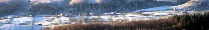
- North Pennines
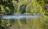
- Dales Fringe
- West Durham Coalfield
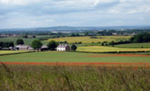
- Wear Lowlands
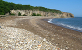
- East Durham Limestone Plateau
- Tees Lowlands
Written descriptions of the Local Landscape Types for each of the County Character Areas and maps of the Local Landscape Types and sub-types for each of the individual Broad Landscape Type can be viewed or download as pdfs below:
North Pennines
Maps
Maps of the Local Landscape Types and sub-types for each of the individual Broad Landscape Type within the North Pennines can be viewed or download as pdfs below:
- Local Landscape Types Map – Moorland Ridges and Summits (PDF, 850kb)
- Local Landscape Types – Moorland Plateau Map (PDF, 79kb)
- Local Landscape Types Map – Moorland fringe (PDF, 465kb)
- Local Landscape Type – Upper Dale Map (PDF, 245kb)
- Local Landscape Types – Middle Dale Map (PDF, 694kb)
- Local Landscape Type Map – Lower Dale (PDF, 398kb)
Alternatively view an interactive map of Local Landscape Types for the whole of the North Pennines County Character Area.
Dales Fringe
Written description of Dales Fringe Local Landscape Types (PDF, 672kb)
Maps
Maps of the Local Landscape Types and sub-types for each of the individual Broad Landscape Type within the Dales Fringe can be viewed or download as pdfs below:
- Local Landscape Types – Gritstone Upland Fringe Map (PDF, 804kb)
- Local Landscape Types – Gritstone Vale Map (PDF, 887kb)
Alternatively view an interactive map of Local Landscape Types for the whole of the Dales Fringe County Character Area.
West Durham Coalfield
Maps
Maps of the Local Landscape Types and sub-types for each of the individual Broad Landscape Type within the West Durham Coalfield can be viewed or download as pdfs below:
- Local Landscape Types – Coalfield Upland Fringe Map (PDF, 1Mb)
- Local Landscape Types – Coalfield Valley Map 1-4(PDF, 1Mb)
- Local Landscape Types – Coalfield Valley Map 1-5 (PDF, 1Mb)
Alternatively view an interactive map of Local Landscape Types for the whole the West Durham Coalfield County Character Area.
Wear Lowlands
Maps
Maps of the Local Landscape Types and sub-types for each of the individual Broad Landscape Type within the Wear Lowlands can be viewed or download as pdfs below:
- Local Landscape Types – Lowland Valley Terraces Map (PDF, 917kb)
- Local Landscape Types – Incised Lowlands Map (PDF, 924kb)
Alternatively view an interactive map of Local Landscape Types for the whole of the Wear Lowlands County Character Area.
East Durham Limestone Plateau
Maps
Maps of the Local Landscape Types and sub-types for each of the individual Broad Landscape Type within the East Durham Limestone Plateau can be viewed or download as pdfs below:
- Local Landscape Types – Limestone Escarpment Map (PDF, 1006kb)
- Local Landscape Types – Clay Plateau Map (PDF, 851kb)
- Local Landscape Types – Coastal Limestone Plateau Map (PDF, 851kb)
- Local Landscape Types – Limestone Coast Map (PDF, 570kb)
Alternatively view an interactive map of Local Landscape Types for the whole of the East Durham Limestone Plateau County Character Area.
Tees Lowlands
Maps
Maps of the Local Landscape Types and sub-types for each of the individual Broad Landscape Type within the Tees Lowland can be viewed or download as pdfs below:
- Local Landscape Types – Lowland Vale Map (PDF, 747kb)
- Local Landscape Types – Lowland Carrs Map (PDF, 735kb)
- Local Landscape Types – Lowland River Terraces Map (PDF, 576kb)
- Local Landscape Types – Lowland Plain Map (PDF, 935kb)
Alternatively view an interactive map of Local Landscape Types for the whole of the Tees Lowlands County Character Area.