Lowland Plain
View interactive map of Broad Landscape Types
Key Characteristics
- Open lowland plain.
- Permian rocks are masked by a thick mantle of glacial clays, sands and gravels.
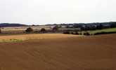
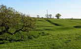
- Gently rolling or undulating topography with areas of flat or hummocky terrain.
- Seasonally waterlogged brown and reddish-brown clay soils with pockets of brown earths and brown sands.
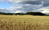
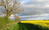
- Mixed but largely arable farmland of cereals and oil-seed rape.
- Semi-regular patterns of old enclosures, often fragmented by amalgamation into large arable fields.
- Low clipped hawthorn hedges.
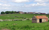
- Relics of rigg and furrow in older pastures.
- Few trees – thinly scattered hedgerow ash, oak and sycamore.
- Sparsely wooded but with some heavily wooded areas of old parkland and estate farmland.
- Nucleated pattern of small green villages connected by winding lands. Many shrunken or deserted medieval villages. Scattered farms.
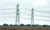
- Busy trunk roads and overhead transmission lines in places.
- A visually open and broad scale landscape with long distance views to the Cleveland Hills to the south.
- Heavily wooded areas create a greater degree of enclosure and a more intimate scale.
- A sparsely settled rural landscape.
Description
An open lowland plain. A thick mantle of glacial drift of boulder clays and sands and gravels masks the underlying Permian rocks. The topography is flat, gently rolling or gently undulating, with areas of more hummocky terrain associated with glacial moraines and pockets of sands and gravels. Watercourses are small and inconspicuous, often straightened to follow field boundaries, and occasionally incised in small shallow denes. Soils are heavy, seasonally waterlogged brown and reddish-brown clays with pockets of stonier brown earths and brown sands.
Agricultural land use is mixed but largely arable, dominated by the cultivation of cereals and oil-seed rape. Field boundaries are hawthorn hedges and are usually cut low. Field patterns are semi-regular, most dating from the enclosure of the common fields of older villages in the 1600s. Field systems are heavily fragmented in places by amalgamation into large arable fields.
Tree cover is low, with thinly scattered hedgerow ash, oak and sycamore. The landscape is generally very open and sparsely wooded with occasional small broadleaved plantations. It is locally more heavily wooded in areas of old parkland or wooded estate farmland.
The landscape has a long history of settlement and a nucleated pattern of small green villages, most of Saxon or later medieval origins. Buildings are of Carboniferous sandstone imported from landscapes to the west. Roofs are usually of clay pan tile. The settlement pattern is relatively sparse and there are many shrunken or deserted medieval villages. Isolated farms, often with large agricultural buildings and grain silos, are scattered across the plain. In areas of undulating terrain they often sit in prominent positions on low sand hills. Villages and farms are connected by a network of narrow hedged lanes. The plain is crossed by a number of busier modern highways, and by overhead transmission lines.
A visually open and broad scale landscape in which the Cleveland Hills form a distant horizon to the south. Despite the low tree cover, hedgerow trees are often important skyline features and help articulate and define space. In heavily wooded areas there is a greater degree of enclosure and a more intimate scale. A sparsely settled rural landscape.
Broad Character Areas
The Lowland Plain landscape type is represented by four Broad Character Areas.
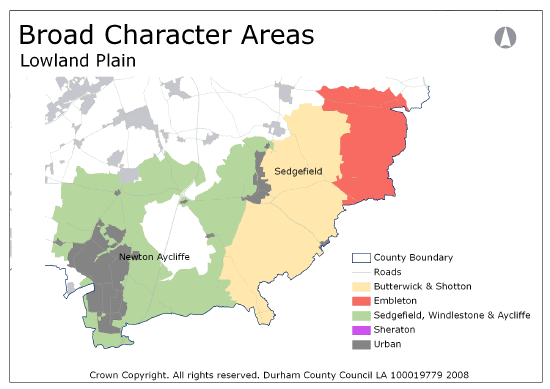
View interactive map of Broad Character Areas
Butterwick and Shotton. Open flat or gently undulating arable farmland east of Sedgefield. A landscape of large arable fields with a fragmented boundary network of clipped hedges and few trees. Small pockets of pasture have more intact old field systems, scattered hedgerow ash and oak and occasional fragments of rigg and furrow. Tree lines follow small watercourses and ditches. Scattered farms and hamlets or farm clusters are connected by narrow lanes. Woodland cover is very low, with thinly scattered small broadleaved plantations. The area is crossed by the busy A177 and A689 and by major transmission lines.
Embleton. Gently rolling or flat wooded farmland. A patchwork of improved pasture and arable fields bounded by a fragmented network of old hedges, clipped low in places; tall and overgrown in others. There are few hedgerow trees. Broadleaved woodlands lie in incised steep sided denes of the branching Amerston Beck, and mixed plantations are scattered across the area. The Hurworth Burn Reservoir lies on the River Skerne in the north. Isolated farms are connected by narrow winding lanes and farm tracks. The area is crossed by the Castle Eden walkway on a disused railway line.
Sedgefield, Windlestone and Aycliffe. Gently undulating or rolling farmland in the fringes of the lowland carrs. A patchwork of arable and improved pasture, but predominantly arable, with old pre-enclosure field systems which are locally fragmented. Field boundaries are hedges, usually clipped low, with scattered hedgerow trees. Tree lines follow small watercourses and ditches. Small broadleaved plantations are scattered across the area. There are more heavily wooded areas associated with parklands at estate farmland at Hardwick and Windlestone. The large new town of Newton Aycliffe lies in the west and the large village of Sedgefield in the east. Smaller villages and scattered farms are connected by narrow lanes. The area is crossed by the busy A167 and A689. There are occasional small limestone quarries and old sand pits.
Local Landscape Types
Local Landscape Types and sub-types are identified at a detailed level and reflect localised variations in landscape characteristics. A map of the Local Landscape Types and sub-types for the Lowland Plain Broad Landscape Type can be downloaded as a PDF below:
Local Landscape Types – Lowland Plain Map (PDF, 935kb)
Alternatively you can view an interactive map of Local Landscape Types for the whole of the Tees Lowlands County Character Area.
For a written description of the Local Landscape Type and sub-types for the Tees Lowlands County Character Areas download the following PDF:
Tees Lowlands Local Landscape Types (PDF, 1Mb)
Further Information
Further Broad Landscape Types with in the Tees Lowlands
or

