Tees Lowlands
Key Characteristics
- A broad lowland plain of gently undulating, occasionally flat terrain.
- Carboniferous and Permian limestones and sandstones are masked by thick layers of glacial drift.
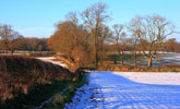
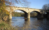
- The meandering River Tees flows through the heart of the area on a narrow floodplain between low gravel terraces.
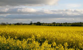
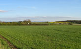
- An open landscape of arable and mixed farmland on clay soils.
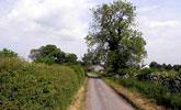
- Sub-regular patterns of low clipped hedges, often fragmented by the amalgamation of arable fields, with scattered hedgerow oak and ash
- Low lying ‘flats’ and ‘carrs’ with peaty or alluvial soils are drained by ditches and stells.
- Occasional heavily wooded parklands – woodland cover is generally low elsewhere.
- A nucleated settlement pattern of old villages connected by winding lanes and occasional larger towns.
- Older buildings are typically of sandstone with clay pan-tile roofs.
- Numerous deserted or shrunken medieval villages. Relics of rigg and furrow cultivations.
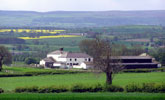
- A visually open and broad scale landscape with panoramic views to distant hills.
- A predominantly rural landscape with occasional larger settlements, busy roads, railway lines and overhead transmission lines.
Description
The lowlands of the Tees form a broad plain that merges with the gentle dip slope of the Magnesian Limestone escarpment and the low hills of the Pennine fringe in the north. The underlying geology of Permian limestones in the east and Carboniferous sandstones, mudstones and shales in the west is generally masked by deep glacial drift.
The topography is gently rolling or undulating with low lying ‘flats’ and ‘carrs’ and areas of more undulating terrain relating to pockets of fluvio-glacial sands and gravels. The River Tees falls very gradually to the North Sea; its meandering course incised between low terraces and flat gravel benches. It is fed by slow moving tributaries like the River Skerne which have been straightened and deepened in places. Water levels in the carrs are maintained by systems of ditches and stells. Soils are heavy drift-derived surface water gleys, with pockets of brown earths on gravels, and earthy peats in poorly drained carrs.
Agricultural land use is mixed but predominantly arable. Field systems are ‘sub-regular’ in pattern and largely date from the enclosure of open town fields in the 16th and 17th centuries. They have been heavily fragmented by the amalgamation of arable fields in the 20th century. Hedgerows tend to be cut low and regularly trimmed. Tree cover is generally low with scattered hedgerow trees, principally Ash and Oak, though some areas are rich in trees. In the carrs field boundaries are water-filled ditches, often supplemented by fences.
Woodland cover is sparse, being generally restricted to a scattering of small plantations although there are some heavily wooded areas associated with ornamental parklands. There are occasional narrow riverside woods along the Tees.
The settlement pattern is nucleated with small ‘green’ villages of Saxon or medieval origins connected by winding lanes. There are many deserted medieval villages, or shrunken villages reduced to single farms or farm clusters. The landscape is predominantly rural though with occasional larger settlements including, in Durham, the modern new town of Newton Aycliffe. The plain is crossed by a number of major roads (the A1(M), A66 and A68) and railway lines and by overhead transmission lines.
The landscape is generally open and broad in scale. The Cleveland Hills form a strong far horizon in the south and east. In flat or rolling areas views of the landscape tend to be shallow and skyline features such as hedgerow trees and woodlands become important in defining and articulating space.
View interactive map of County Character Areas
Broad Landscape Types
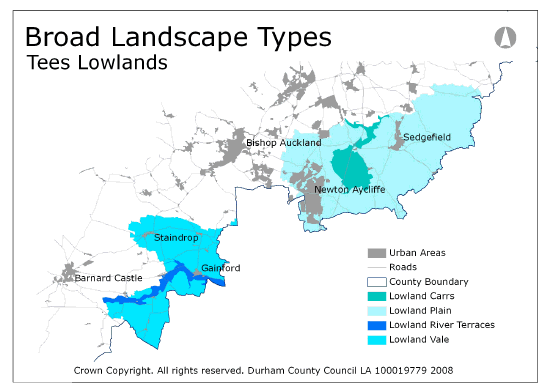
Landscapes of very similar character cover large tracts of the Tees Plain. A broad distinction can be made between the open arable landscapes of the Lowland Plain in the east, and the mixed farmland of the Lowland Vale with its frequent villages to the west. The flat Lowland Carrs of the River Skerne are distinguished by their peaty and alluvial soils, their wet pastures and boundary ditches: the Lowland River Terraces of the River Tees by their sand and gravel soils and their association with the meandering River Tees.
View interactive map of Broad Landscape Types


