Coalfield Valley Floodplain
View interactive map of Broad Landscape Types
Key Characteristics
- Flat, narrow floodplains fringed in places by low, steep-sided bluffs.
- Meandering rivers with alternating riffles and pools.
- Alluvial soils.
- Large arable fields protected from flooding in places by low levees.
- Smaller pastures of improved or semi-improved wet pastures bounded by low thorn hedges with scattered hedgerow oak, ash and alder.
- Ancient woodlands of oak and birch on steep bluffs.
- Narrow riparian woods or tree lines of alder, oak, ash and willow on river banks.
- Semi-improved pastures on steeper bluffs with scattered scrub of gorse or hawthorn.
- Occasional small ponds and ox-bow lakes and larger wetlands in abandoned or restored gravel workings.
- Few farms or farm buildings.
- Occasional relics of corn or fulling mills or later iron-working mills – including mill races and buildings.
- Occasional industrial land or sewerage works bordering larger settlements.
- A diverse landscape. Enclosed and intimate in scale in wooded areas but more open, and reading as part of the wider valley landscape, in others.
Description
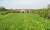
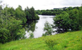
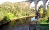
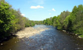
The floodplains of the larger coalfield valleys are generally narrow (200 – 500m), bordering onto the moderate slopes of the wider valley or fringed by low, steep-sided bluffs. Rivers are meandering with alternating shallow, quick flowing riffles and broader slow moving reaches. There are occasional small natural ponds and ox-bow lakes and larger wetlands in flooded gravel workings.
The flat and fertile alluvial soils of the floodplain support arable cropping of cereals and oil-seed rape on land protected from flooding by low levees. Elsewhere land use is pastoral, with improved grasslands and areas of less improved wet or marshy pasture.
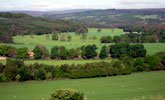
Field systems on the ‘haughs’ or ‘flatts’ of the floodplain are generally irregular or sub-regular in pattern, dating from the enclosure of common meadows and pastures in and around the 17th century. In arable areas many of these enclosures have been amalgamated to form large, open fields. In pastoral areas fields are smaller and bounded by low hawthorn hedges with scattered hedgerow oak, ash and alder. On the steeper slopes of the floodplain bluffs, pastures that have always been difficult to manage or improve are scattered with gorse or hawthorn scrub.
The landscape is well wooded. Ancient woodlands of oak and birch lie on steep bluffs overlooking the haughs and narrow riparian woods or tree lines of alder, oak, ash and willow line the riverbanks.
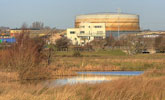
There are few farms or farm buildings on the floodplain itself though they occur occasionally on isolated pockets of higher ground. On parts of the floodplain bordering larger towns, the flat land has been developed for industry or for sewerage works. Relics of water mills – for grinding corn, preparing cloth or working iron and steel – in the form of dams, mill races and mill buildings are scattered across the more settled floodplains. Parts of the floodplain have been worked for sand and gravel leaving flooded gravel pits, some of which have been restored as fishing lakes or nature reserves.
A very diverse landscape, enclosed and intimate in scale in its narrower and more heavily wooded sections but more open, and reading as part of the wider valley landscape, in others.
Broad Character Areas
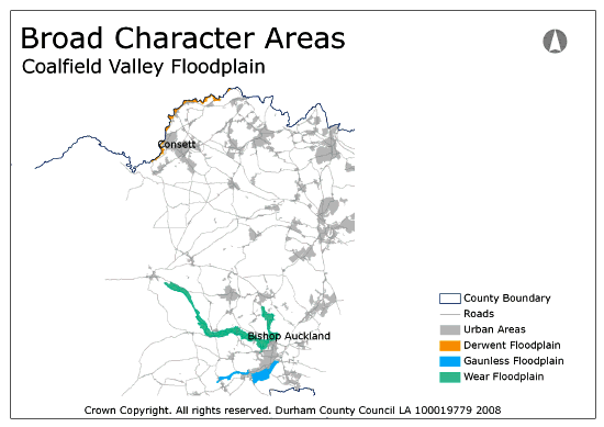
The Coalfield Valley Floodplain landscape type is represented by three Broad Character Areas.
View interactive map of Broad Character Areas
The Derwent Floodplain. The narrow floodplain of the River Derwent is largely pastoral with open improved or semi-improved pastures on the flat haughs either side of the river. Low bluffs define the floodplain, clothed in broadleaved or mixed woodland or semi-improved pasture and scrub. The river is followed by narrow riparian woods or tree lines of willow, alder, ash and oak. The valley floor of the Derwent is settled in places and urban fringe recreation grounds, playing fields and sewerage works are found along the floodplain. The valley was important for steel making in the early industrial revolution and there are remains of a number of old water powered forges (most notably at Derwentcote), as well as old water mills and tile works.
The Gaunless Floodplain. The River Gaunless meanders slowly across flat haughs of wet pasture with oxbow lakes and low river terraces marked by sporadic tree lines.
The Wear Floodplain. The River Wear meanders across a broad floodplain, defined in places by low bluffs of broadleaved woodland or steep pasture with scattered scrub. Narrow riparian woodlands of willow, alder, oak and ash follow the river. The farmland of the floodplain is mixed, with areas of improved pasture and arable cropping divided in places by straight hawthorn hedges. Parts of the floodplain have been worked for sand and gravel. Some abandoned gravel pits have naturally re-vegetated and are now managed for nature conservation; others have been restored as fishing lakes.
Local Landscape Types
Local Landscape Types and sub-types are identified at a detailed level and reflect localised variations in landscape characteristics. A map of the Local Landscape Types and sub-types for the Coalfield Valley Floodplain Broad Landscape Type can be downloaded as a PDF below:
Local Landscape Types – Coalfield Valley Floodplain Map (PDF, 717kb)
Alternatively you can view an interactive map of Local Landscape Types for the whole of the West Durham Coalfield County Character Area.
For a written description of the Local Landscape Type and sub-types for the West Durham Coalfield County Character Areas download the following PDF:
West Durham Coalfield Local Landscape Types (PDF, 1018kb)
Further Information
Further Broad Landscape Types with in the West Durham Coalfield:
or

