Coalfield Valley
View interactive map of Broad Landscape Types
Key Characteristics
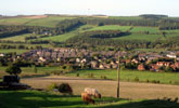
- Broad, well defined valleys with occasional narrow floodplains and incised denes.
- Rounded topography of thinly bedded sandstones, mudstones, shales and coals overlain by glacial boulder clays.
- Heavy, seasonally waterlogged, clay soils.
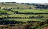
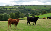
- Mixed farmland of improved pasture and arable cropping.
- Sub-regular field patterns of old enclosures bounded by thorn hedges. Occasional regular Parliamentary enclosures.
- Scattered hedgerow Oak, Ash, Sycamore and Beech.
- Variable woodland cover – open in places but wooded elsewhere with ancient oak-birch woods in narrow denes and along watercourses, and blocky conifer plantations on valley sides.
- Scattered mining towns and villages connected by busy modern roads.
- Occasional older ‘green’ villages linked by narrow winding roads.
- Extensive areas of restored opencast land and reclaimed colliery land – often open and relatively featureless.
- Scattered relics of the mining industry – small spoil heaps, coke ovens and railway lines.
- Occasional ornamental parklands.
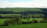
- An open landscape, relatively broad in scale but defined by enclosing ridgelines.
- A strongly rural landscape in places but with a ‘semi-rural’ or urban fringe quality in its more settled areas.
Description
Broad, well defined valleys with moderately sloping sides and occasional narrow floodplains. Soft and thinly bedded sandstones, coal and shales of the coal measures are covered by glacial drift of boulder clay with pockets of sands and gravels giving rise to gently rounded topography. Small rivers, ‘becks’ and ‘burns’ cut down into the valley floor drift in places creating narrow, steep sided denes.
Heavy, seasonally waterlogged, clay soils support a mosaic of mixed farmland with the emphasis shifting from pasture in the upper valleys to arable cropping – mostly cereals and oil-seed rape – in the lower reaches. Field boundaries are mostly hedges – cut low in arable areas, but often tall and overgrown in pastoral areas. Field systems are generally ‘sub-regular’ in pattern, dating from the enclosure of arable town fields around older villages or intakes from the open fells. More regular grids of parliamentary enclosures are found on higher valley sides.
Tree and woodland cover varies considerably. The valleys are very open in some places and heavily wooded or rich in hedgerow trees in others. Ancient oak and oak-birch woods are found in narrow denes on the valley floor. Younger broadleaved woodlands of pioneer species like birch, alder and willow follow old railway lines and colliery land. Larger plantations, often of pine or larch, are scattered across the valley sides. Hedgerow oak, ash, sycamore and occasionally beech are common. In places these combine with streamside alder and tall overgrown hedges to give a well-wooded character to the landscape.
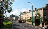
Mining towns and villages are scattered across the valleys connected by a well-developed road network. Most of these have a core of 19th century terraced housing of brick or stone and welsh slate surrounded by estates of post-war public housing. Settlement edges are often abrupt or fringed by allotment gardens, pony paddocks and industrial land. This settlement pattern overlies and largely obscures an older network of small agricultural villages that survives in the more rural upper valleys. These older villages often have a core of buildings of local stone set around a central village green. There are occasional small parklands, mostly associated with 19th century country houses.
The valley landscape has been heavily influenced by coal mining although much of its legacy has been removed by land reclamation in recent years. Some elements of the industrial landscape remain – notably railway lines, tramways, small waste heaps and old coke ovens. Land reclamation and opencast coal mining have had a substantial impact on the more settled parts of the landscape where extensive tracts of land have been worked and restored to agriculture or forestry. Reclaimed or restored land is often relatively featureless or lacking in maturity.
The landscape is broad in scale, defined within the valleys by the enclosing ridgelines, with panoramic views from higher ridges across adjacent valleys. Locally within the more wooded sections of some valleys the scale is more intimate and enclosed. The landscape of the coalfield has been heavily influenced by urban and industrial development and its scattered mining towns and villages and busy roads give it a semi-rural or urban fringe character in places. In the less developed areas it retains a strongly rural quality.
Broad Character Areas
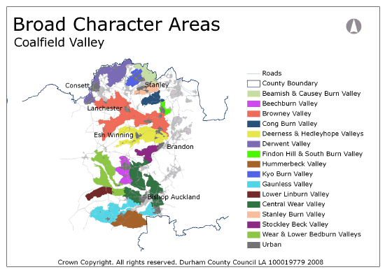
The Coalfield Valley landscape type is presented by fifteen Broad Character Areas.
View interactive map of Broad Character Areas
Beamish & Causey Burn Valley. A broad valley in which the upper reaches of the River Team and its tributaries carve a winding course, incised in narrow steep-sided denes. In the west ancient oak woods lie in the denes between open, gently rolling, arable farmland. In the east lies the heavily wooded estate landscape of Beamish Hall which contains the Beamish Open Air Museum. The area is notable for its industrial heritage, with the remains of water-powered forges along the river, and Causey Arch, the world’s oldest surviving railway bridge, spanning the deep wooded gorge of the Causey Burn. Areas of derelict colliery land and spoil heaps lie in the Wheatley Gill/Bobgins burn valley to the north near Marley Hill.
Beechburn Valley. A broad, settled valley running northwards from the Wear. Its western slopes are gently sloping. Its eastern slopes rise more steeply to a well-defined ridge running from Dowfold Hill to Rumby Hill. The town of Crook lies in the head of the valley. Smaller colliery villages are scattered across the valley. An open pastoral landscape with some areas of arable cropping on the valley floor and ridge tops. Field systems are generally old with sub regular patterns of hedgerows and scattered hedgerow oak, ash and sycamore. Areas of parliamentary enclosure with regular field patterns and straight enclosure roads are found on the eastern ridge. There are scattered areas of reclaimed colliery land.
Browney Valley. A broad branching valley in which the Browney and its tributaries lie on narrow floodplains or in narrow, steep-sided denes. Valley sides are moderately sloping with occasional steeper bluffs. Arable and mixed farmland in the lower reaches of the valley gives way to pasture on higher ground. The valley is heavily wooded in places with large blocky conifer plantations, and broadleaved or mixed woodlands in areas of old parkland. Field systems vary in character with older hedges with scattered or abundant hedgerow trees in the valley bottoms, and areas of regular parliamentary enclosure on higher ground. Boundaries are mostly hedgerows with some dry stone walls in the upper reaches. Large villages lie along the valley floor and the lower valley sides. Restored opencast land is found in many places on the upper slopes, and areas of reclaimed colliery land are found around some mining villages.
Cong Burn Valley. A well defined valley lying between high ridges in which the Cong Burn lies in a narrow steep sided dene lined with ancient oak woods. Large blocks of conifers rise up the steep slopes of Charlaw Fell to the south. The gentler south facing slopes are predominantly arable with low hedges and few trees. Field patterns are mixed, with regular parliamentary enclosures and straight enclosure roads in places and older fields around the village of Holmside. There are several areas of restored opencast land.
Deerness and Hedleyhope Valley. The branching valley of the River Deerness and its tributaries. In its lower reaches the Deerness lies in an incised dene, a mosaic of woodland and pasture, between open gentle slopes of mixed farmland on which lie the mining villages of New Brancepeth and Ushaw Moor, and the parklands of Ushaw College and Eshwood Hall. Upstream, steep wooded bluffs south of the river overlook the village of Esh Winning. The upper reaches of the Deerness are pastoral and heavily wooded with large conifer plantations and a network of old hedges, with frequent oak trees, fragmented in places by opencast mining. The upper reaches of the Hedleyhope valley are also well wooded with mixed farmland of old hedgerows and abundant oak and ash trees interspersed with broadleaved and mixed woodlands.
Derwent Valley. The broad valley of the River Derwent straddles the northern county boundary. The valley is heavily wooded, with ancient oak woods lying in branching denes and large coniferous or mixed plantations on the valley sides. Agricultural land use is largely pastoral with sub regular networks of old hedges with scattered, locally abundant, oak, ash, beech and sycamore trees. Mining villages are strung out along the valley and the large industrial town of Consett lies on the valley side falling from the southern ridge. The tributary valley of the Pont burn is more rural with thinly scattered farms. The valley is notable for its industrial heritage. The Derwent Valley walk follows a disused railway line with several landmark viaducts over wooded denes which have commanding views across the valley.
Findon Hill & South Burn Valley. The high ground of Findon Hill and Daisy Hill in the head of the Southburn Valley. The large mining village of Sacriston lies below steep wooded bluffs bordering Charlaw Fell. Agricultural land use is mostly arable with large fields bounded by low trimmed hedges and few trees. Field systems are regular and date from parliamentary enclosures or from more recent opencast coal mining.
Hummerbeck Valley. Gently rolling, in places almost flat, plateau of mixed farmland drained by the Hummer Beck and the Oakley Cross Beck. Field systems are generally pre-enclosure with sub-regular patterns of hedgerows, frequent hedgerow oak, ash and sycamore. Lines of trees follow the becks and there are scattered coniferous or mixed plantations. Some areas have been opencast for coal and contain young hedges and plantations and new stone walls. The area is sparsely settled with scattered farms served by narrow lanes.
Kyo Burn Valley. The broad valley of the Kyo Burn is encircled by settlements on the surrounding ridge tops. An open pastoral landscape of improved or wet rushy pasture with a fragmented network of old, often overgrown, hedgerows and few trees. Fragments of heathland and gorse scrub are found on steeper slopes. The Kyo burn is slightly incised in the valley floor with wooded sections containing ancient oak woods.
Gaunless Valley. The River Gaunless meanders across a narrow floodplain, its banks lined with willow and alder. Tributary streams lie in narrow wooded denes. Ancient oak woodlands of Crag Wood lie on steep slopes overlooking the river. Agricultural land use is mixed with tracts of open arable farmland and improved or semi-improved pasture, and open moor of grass and bracken at Cockfield Fell. Field systems vary in character with areas of regular parliamentary enclosure, early post-medieval field systems around older villages, and large areas of restored opencast land with young hedges, shelterbelts and plantations. A settled rural landscape with old agricultural villages, enlarged during the industrial period, and numerous scattered farms and building clusters. The valley is notable for its mining heritage, and particularly on Cockfield fell where 19th century railways lie alongside medieval bell pits and Iron Age settlements.
Linburn Valley. A simple broad valley in which the Linburn Beck winds across the valley floor, its banks lined with willow and alder, occasional incised in shallow wooded denes. A pastoral landscape of improved and semi-improved pastures bounded by old hedges with frequent hedgerow oak, ash and sycamore. Scattered farms are served by narrow roads.
Central Wear Valley. A broad winding valley with moderate slopes falling to steeper bluffs beside the floodplain of the River Wear. A settled landscape with the large town of Bishop Auckland on the valley floor and numerous small mining villages scattered across the valley sides. Agricultural land use is mixed with tracts of open arable farmland and improved pasture bounded by old hedges with scattered, locally abundant, hedgerow trees. Tributary burns are incised in narrow wooded denes. The wooded parklands of Auckland Park lie to the north of Bishop Auckland. Older villages are served by a network of narrow lanes. Busy modern roads radiate out from the town. The area is notable for its Roman remains at Binchester.
Stanley Burn Valley. A broad valley dominated by the town of Stanley which lies on its northern flanks. Ancient oak woods lie in the dene of the Stanley Burn which winds between moderately sloping valley sides of open arable farmland. Field systems are largely pre-enclosure with fragmented patterns of low clipped hedges and few hedgerow trees. There are scattered coniferous plantations. The landscape of the valley has a very settled character with prominent mining villages and areas of recreational land. Fragments of heathland survive on the southern ridge in South moor Golf Course.
Stockley Beck Valley. The narrow valley of the Stockley Beck broadens as it approaches the valley terraces of the Wear Lowlands. The beck lies within a broad dene clothed in coniferous woodland. The upper valley is open pasture with regular grids of parliamentary enclosure walls and hedges and few trees. Parts of the area have been opencast and contain young hedges and new walls. The broader flanks of the lower valley have fragmented field systems of older hedges around arable fields and improved pastures which are interspersed by scattered conifer plantations. Scattered farms are served by narrow roads.
Upper Wear and Bedburn Valleys. The broad valley of the Wear and its tributary the Bedburn are well wooded, with frequent plantations, wooded denes, and areas of wooded parkland and estate farmland on valley slopes overlooking the Wear floodplain. Agricultural land use is mixed with a mosaic of improved pasture and arable cropping. Field systems are largely pre-enclosure with sub-regular patterns of hedgerows and occasional dry stone walls with scattered, locally abundant, hedgerow oak, ash and sycamore. Scattered farms are served by narrow roads and tracks. Old villages lie on high ground along the valley.
Local Landscape Types
Local Landscape Types and sub-types are identified at a detailed level and reflect localised variations in landscape characteristics. A map of the Local Landscape Types and sub-types for the Coalfield Valley Broad Landscape Type can be downloaded as a PDFbelow:
Local Landscape Types – Coalfield Valley Map (PDF, 1Mb)
Alternatively you can view an interactive map of Local Landscape Types for the whole of the West Durham Coalfield County Character Area.
For a written description of the Local Landscape Type and sub-types for the West Durham Coalfield County Character Areas download the following PDF:
West Durham Coalfield Local Landscape Types (PDF, 1018kb)
Further Information
Further Broad Landscape Types with in the West Durham Coalfield
or

