West Durham Coalfield
Key Characteristics
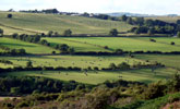
- A rolling low upland landscape of ridges and valleys with a strong east-west grain.
- Soft and thinly bedded strata of Carboniferous sandstones, shales and coals give rise to gently rounded ridges with occasional steeper bluffs.
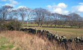
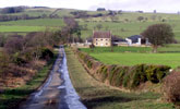
- Open ridges of pastoral farmland with regular grids of dry stone walls or gappy thorn hedges are crossed by straight enclosure roads and lanes. Fragments of heathland survive on infertile acidic soils.
- Valleys are broad with moderate slopes and occasional narrow floodplains. Agricultural land use is mixed with arable fields and improved pastures bounded by hawthorn hedges with scattered hedgerow oak and ash.
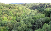
- Ancient oak woods are found in narrow steep sided denes, and along the banks of rivers and streams.
- Coniferous plantations are found on higher valley sides and ridges.
- Old agricultural villages lie on ridge tops or valley floors. Buildings are of local sandstone with roofs of stone or welsh slate.
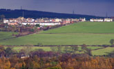
- Mining villages of Victorian terraced housing of brick or stone and welsh slate and later estate housing are scattered across the valleys and ridges.
- Occasional parklands and wooded estates surround small country houses.
- Relics of the mining industry include disused railway lines and viaducts, old coke ovens and small spoil heaps.
- 0pencast coal workings are locally prominent features. Extensive areas of land have been opencast or reclaimed and their landscape often lacks maturity.
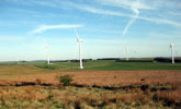
- The landscape is broad in scale, defined within the valleys by the enclosing ridgelines, with panoramic views from higher ridges across adjacent valleys.
- A landscape heavily influenced by development with a semi-rural or urban fringe character in places.
Description
An upland fringe landscape of well-defined ridges and valleys running generally eastwards from the North Pennines to the lowland valleys of the Tyne and Wear. Its character is transitional between the two, with a strong upland fringe quality on higher ground in the west becoming less marked as the land falls and merges with the lowlands to the east.
The soft and thinly bedded sandstones, coal and shales of the coal measures give rise to gently rounded ridges with occasional steeper bluffs. The glacial drift covering the valley floors and lower slopes is incised in places by the small becks and burns which now occupy the broad valleys of once much larger glacial streams. The larger rivers have narrow floodplains.
The higher ridges and valley heads in the west are generally very open and pastoral, with large regular fields bounded by sparse overgrown hawthorn hedges, dry stone walls or fences with few hedgerow trees. Most of these fields were laid out in parliamentary enclosures of the 18th century and contain isolated farms linked by straight roads and lanes. Fragments of heathland survive on infertile or waterlogged acidic soils. Woodland cover is generally low with scattered blocks or shelterbelts of conifers and narrow linear woodlands of oak and birch or alder following watercourses and incised valleys.
In the more sheltered valleys agricultural land use is mixed with an increased emphasis on cereal cropping. Hedges tend to be cut low and the pattern of the landscape changes much with the seasons. Tree and woodland cover varies considerably, the valleys being very open in places and heavily wooded or rich in hedgerow trees elsewhere. Ancient oak woods are found in steep sided denes and, together with alder woods, on the banks of rivers and streams. Larger plantations, often of pine or larch, are scattered across the valley sides. There are occasional parklands – some of medieval origins but more typically associated with small 19th century country houses.
Old agricultural villages are scattered thinly across the landscape, often on ridge-top sites. Buildings are of local sandstone with roofs of stone flag, slate or clay pantile and are usually set around a village green. Mining and industrial towns and villages are more common and are concentrated in the north and east of the coalfield and along the valley of the Wear. Most of these settlements have a core of 19th century terraced housing of brick or stone and welsh slate surrounded by estates of post-war public housing. They tend to occupy prominent sites on ridge tops and valley sides and are connected by a well-developed road network. Settlement edges are often abrupt or fringed by allotment gardens and pony paddocks.
The wider landscape has been heavily influenced by coal mining. Some elements of the industrial landscape remain, notably railway lines, tramways, small waste heaps and old coke ovens, but many have been removed by land reclamation in recent years. Opencast mining has had a substantial impact on parts of the landscape where extensive tracts of land have been worked and restored to agriculture. Reclaimed or restored land is often relatively featureless or lacking in maturity.
The landscape is broad in scale, defined within the valleys by the enclosing ridgelines, with panoramic views from higher ridges across adjacent valleys. Locally within the more wooded sections of some valleys the scale is more intimate and enclosed. The landscape of the coalfield has been heavily influenced by urban and industrial development and its scattered mining towns and villages and busy roads give it a semi-rural or urban fringe character in places. In the less developed areas it retains a strongly rural quality.
View interactive map of County Character Areas
Broad Landscape Types
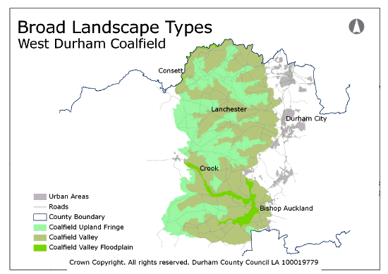
The West Durham Coalfield can be broadly divided into those landscapes with an upland fringe character (parliamentary enclosures, dry stone walls, pastoral land use and conifer plantations) which are found on the high ridges and valley heads, and those with a lowland character (older field systems, hedgerows, mixed and arable farming) which are found in the lower reaches of the valleys. The settlement pattern of the coalfield with its scattered mining villages doesn’t relate strongly to this distinction – both upland fringe and lowland coalfield landscapes have densely settled and very rural areas.
The landscape assessment identifies Coalfield Upland Fringe and Coalfield Valley landscapes. Within the coalfield valleys the Coalfield Valley Floodplain landscapes, with their very different landform, soils and historical development, are identified as a separate landscape type.
View interactive map of Broad Landscape Types


