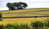
Coalfield Upland Fringe
View interactive map of Broad Landscape Types
Key Characteristics
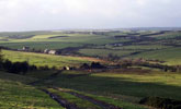
- Broad ridges and shallow valley heads.
- Gently rounded topography of drift free, thinly bedded sandstones, mudstones, shales and coals.
- Occasional steep bluffs and incised denes.
- Heavy, seasonally waterlogged clay soils with pockets of peaty soils supporting heathland vegetation.
- Pastoral land use of improved or semi-improved pasture with some arable cropping on drier ridges.
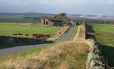
- Regular grids of parliamentary enclosures bounded by dry stone walls or overgrown hawthorn hedges. Occasional older field systems.
- Few trees – scattered hedgerow oak, ash, rowan or birch.
- Sparsely wooded – scattered conifer plantations and shelterbelts.
- Isolated farms connected by straight enclosure roads – occasional old ‘green’ villages of local stone on ridge top sites.
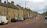
- Scattered mining villages of stone and brick and occasional larger towns.
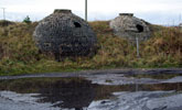
- Occasional relics of the mining industry including small spoil heaps, coke ovens and waggonways.
- Telecommunications masts and wind turbines prominent on some ridges
- Extensive areas of restored opencast land – often open and relatively featureless.
- A visually open landscape with commanding views across adjacent valleys to distant ridges.
Description
An upland fringe landscape made up of the broad ridges and shallow valley heads of the coalfield valleys. The soft and thinly bedded sandstones, shales and coals of the coal measures are generally free of drift or masked by boulder clays giving rise to gently rounded convex slopes. Occasional thicker sandstone beds are marked by steeper bluffs. Small becks and burns drain the upper valleys, occasionally incised in narrow denes. Soils are heavy and seasonally waterlogged. On poorly drained ridges and plateaux, peaty gleys and deeper peats have formed, supporting heathland vegetation of heather, bilberry and acid grassland.
A predominantly pastoral landscape of improved and semi-improved pastures with occasional rougher grazing and wet rushy pasture. There is some limited arable cropping on drier ridge tops in the east. Field boundaries are a mixture of dry stone walls and hedgerows. Walls are made of thinly bedded, locally quarried sandstones. Hedges are dominated by hawthorn and are often tall, leggy, and supplemented by wire fences. Field systems are regular in pattern, dating from the enclosure of moorland wastes in the 18th century under private Acts of Parliament. Some areas of unfenced common land survive on the poorest soils. Earlier hedges and walls are occasionally found around older farms and villages.
Tree and woodland cover is low. The higher ridges are generally open with sparsely scattered hedgerow oak and ash. Thin tree lines follow watercourses. Road verges are often colonised by rowan, birch and willow scrub. Small plantations and shelterbelts of pine and larch are scattered across the ridges and valley heads, with local concentrations creating a more heavily wooded character.
Historically this was a sparsely settled landscape of isolated livestock farms and large tracts of open fell associated with small agricultural villages in the adjacent valleys. Some older villages lie on ridge top sites. Buildings are of local sandstone with roofs of sandstone or welsh slate, and are typically set around a central village green. Scattered farms, most dating from the period of enclosure, are connected by straight and uniform enclosure roads. Mining settlements, ranging from small hamlets and isolated terraces to large towns, are scattered across the ridge tops. Most contain areas of 19th century terraced housing of stone or brick and slate together with estates of post-war public housing and later commercial development. Settlement edges are often abrupt, or fringed by allotments, pony paddocks or industrial estates.
Coal mining and the production of coke and steel have heavily influenced the landscape, although much of the industrial legacy has been removed by land reclamation in recent years. Some relics survive; including small spoil heaps, coke ovens, limekilns, waggonways, bridges and mine buildings. Large tracts of land have been opencast for shallow coal on the exposed drift-free ridges and restored to agriculture or forestry. Older sites in particular were restored with little regard to the character of the landscape and remain open and relatively featureless. Telecommunications masts and wind turbines are prominent features on some ridge tops.
The landscape is visually open and broad in scale with commanding views across the adjacent ridges and valleys. In places it has a remote and strongly rural character, but elsewhere its frequent mining towns and villages, industrial estates, busy roads, communications masts and overhead services give it a semi-rural or urban fringe character.
Broad Character Areas
The Coalfield Upland Fringe landscape type is represented by six Broad Character Areas:
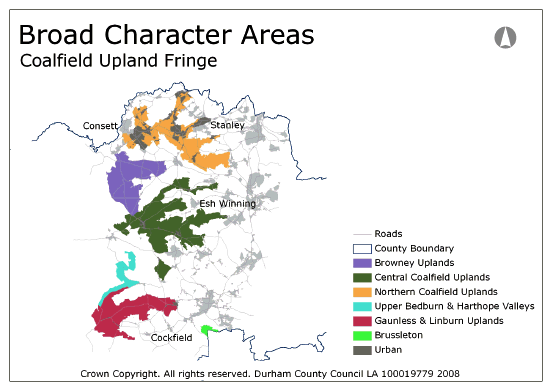
View interactive map of Broad Character Areas
Browney uplands. Gently sloping ridges in the branching head of the Browney Valley. An open pastoral landscape of improved pasture with areas of semi-improved pasture, rough grazing and heathland on higher ground in the west. Field systems are regular and uniform, dating from parliamentary enclosures of the 18th century. Field boundaries are predominantly dry stone walls with some overgrown hedges. The area is crossed by straight and uniform enclosure roads, often lined by trees or scrub. Isolated farms are scattered across the area. The landscape is generally open with scattered small conifer plantations. There are larger plantations in the valleys of the Butsfield and Rippon burns. The coal seams of the Browney uplands are generally thin and unproductive and the area has not been much affected by coal mining. Some areas in the east around Humber Hill and the west along the A68 have been opencast and restored.
Central Coalfield Uplands. A complex of high ridges between the valleys of the Wear and its northern tributaries. The ridges are gently or moderately sloping with occasional steeper bluffs. A pastoral landscape of improved pasture, with fragments of heathland at Hedleyhope Fell and Stanley Moss, and some areas of arable cropping on the drier eastern ridges. Much of the landscape has been opencast for coal and has regular field systems of young hedges, wire fences and new stone walls. Fragments of parliamentary enclosures, and earlier field systems around older villages, survive in places. The landscape is generally open with few mature trees and a scattering of small shelterbelts. Some areas in the west are heavily wooded, with large blocky conifer plantations. Old agricultural villages and later mining villages are scattered along the ridge tops. Wind turbines are notable features of the skyline.
Northern Coalfield Uplands. Densely settled ridges between the northern coalfield valleys. Large mining & industrial towns and villages sprawl along the ridgelines connected by busy roads. Outside of the urban areas land use is largely pastoral. There are fragments of heathland at Chapman’s Well and Annfield Plain. Field systems are regular and uniform, many dating from parliamentary enclosures of the 18th century, others from 20th century opencast coal mining and land reclamation. Field boundaries are a mixture of dry stone walls and overgrown hedges and wire fences. The ridges in the north are generally open in character with few trees or woodlands. Those in the south and west are heavily wooded with frequent large conifer plantations. Telecommunications masts are notable features of the skyline.
Upper Bedburn and Harthope Valleys. The upland fringes of the Bedburn, Harthope and Wear valleys between the coalfield valley landscape of the Wear and the moorland fringes of the North Pennines. Heavily afforested ridges and valley slopes in the edge of Hamsterley Forest. Large regular parliamentary enclosures, bounded by a mixture of walls and hedges, lie between large conifer plantations, and are crossed by straight enclosure roads. Isolated farms are scattered across the area. There is an area of parkland and associated estate lodges at Dryderdale Hall. The village of Hamsterley lies on the southern ridge overlooking the lower Bedburn and Wear valleys.
Gaunless and Linburn Uplands. The upper reaches of the Gaunless and Linburn valleys. A pastoral landscape of improved and semi-improved or wet rushy pastures bounded by sparse, often overgrown, hedgerows, low dry stone walls or wire fences. Field boundaries are mostly regular in pattern, dating from 18th century parliamentary enclosures, or from 20th century opencast coal mining. Roads are generally straight and uniform in width. There are areas of older, less regular, enclosure on south-facing slopes falling from the village of Woodland. The landscape is very open with scattered small plantations and few hedgerow trees. Larger woodlands follow the incised valley of the Arn Gill and Foul Syke, tributaries of the Gaunless. Isolated farms are scattered across the ridges. In the south, farms of the Raby Estate are painted white.
Brussleton. The high ground of Brussleton Hill overlooks the Hummerbeck and Gaunless valleys and merges in the east with the limestone escarpment. The landscape is heavily wooded with ancient oak woods on its north facing slopes, and a dense network of more recent plantations associated with opencast coal mining and land reclamation. Agricultural landuse is mostly pasture. Field patterns vary in character with regular parliamentary enclosures to the north and west, and older enclosures to the east, both heavily disrupted in places by opencast mining. The area is crossed by the Roman road Dere Street, followed by a minor road in the south and a well- defined hollow-way in the north. There are pockets of naturally re-vegetating mining dereliction around the hilltop and a number of telecommunications masts.
Local Landscape Types
Local Landscape Types and sub-types are identified at a detailed level and reflect localised variations in landscape characteristics. A map of the Local Landscape Types and sub-types for the Coalfield Upland Fringe Broad Landscape Type can be downloaded as a pdf below:
Local Landscape Types – Coalfield Upland Fringe Map (PDF, 1Mb)
Alternatively you can view an interactive map of Local Landscape Types for the whole of the West Durham Coalfield County Character Area.
For a written description of the Local Landscape Type and sub-types for the West Durham Coalfield County Character Areas download the following pdf:
West Durham Coalfield Local Landscape Types (PDF, 1018kb)
Further Information
Further Broad Landscape Types with in the West Durham Coalfield:
or

