Moorland Fringe
View interactive map of Broad Landscape Types
Key Characteristics
- Upland landscape of improved moorland fringes, intakes and allotments.
- Varied topography including valleys and upper dale sides.
- Carboniferous rocks bare of drift or covered by boulder clays.
- Hard igneous dolerites outcrop locally in low crags.
- Shallow, infertile or waterlogged peaty soils.
- Wet, rushy pastures, rough grazing and enclosed moorland.
- Large regular fields bounded by low stone walls and wire fences.
- Isolated farms connected by straight roads.
- Scattered conifer plantations and shelterbelts – occasional large tracts of commercial forestry.
- Relics of the lead mining industry – mine buildings, waste heaps, smelter flues, reservoirs and hushes.
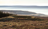
- Visually open and often broad in scale with extensive views across adjacent dales and moors.
- A remote and tranquil landscape on the margins of settlement and agriculture.
Description
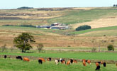
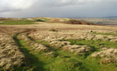
An upland fringe landscape of marginal land lying between the open moors and the more settled, fertile dales. The topography of the moorland fringe is varied and includes minor valleys branching off the main dales and the upper slopes of the dale sides. On the convex slopes of higher dale sides Carboniferous sandstones, limestones, mudstones and shales are bare of drift and the terrain often has a stepped quality reflecting the alternating strata of harder and softer rocks. On lower ground these are masked by glacial drift of boulder clays. Soils are impoverished and often waterlogged – peaty gleys, podzols and heavy surface water gleys.
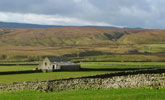
This is a pastoral landscape of wet, rushy pastures and rough grazing of acid grassland, enclosed from moorland wastes in successive waves of agricultural improvement and expansion since the late 18th century. Regular grids of parliamentary enclosures or larger moorland intakes are bounded by low dry-stone walls or wire fences.
The diversity of grasslands, grazed by hardy upland sheep and beef cattle, creates a patchwork of muted and brighter greens reflecting varying degrees of improvement by drainage, liming, and fertilising.
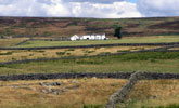
The landscape is sparsely settled with a scattering of isolated farmsteads dating from the period of enclosure – most are small and built of stone with roofs of stone flag or slate. In Teesdale the farms and field barns of the Raby estate in Teesdale are painted white. Roads and tracks also date from the period of enclosure and are characteristically straight and uniform in width.
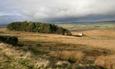
The landscape is generally open with few trees or woodlands. There are occasional clumps of sycamore planted as shelter trees around exposed farms, and scattered conifer plantations and shelterbelts. Parts of the moorland fringe have been given over to larger scale forestry with large Forestry Commission holdings at Hamsterley Forest and The Stang.
Relics of the lead mining industry are common in parts of the moorland fringe. Some of the enclosures and farmsteads date from the expansion of the lead industry and the miner-smallholder economy it generated. Derelict mine buildings, waste heaps, smelter flues, reservoirs and hushes are locally prominent features.
The landscape is visually open and broad in scale with extensive panoramic views across adjacent dales and moors. A remote and tranquil landscape on the margins of settlement and agriculture, often with a neglected ‘run-down’ quality.
Broad Character Areas
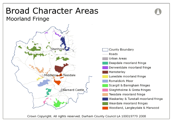
The Moorland Fringe landscape type is represented by eleven broad character areas.
View interactive map of Broad Character Areas
Deepdale Moorland fringe. Open flat or gently rolling pastures and rougher moorland intakes in the eastern edges of the moorland plateau. Large regular enclosures bounded by stones walls and wire fences cover Battle Hill. Smaller and less regular field systems surround older farms at Loups Hill, Stony Keld and Levy Pool, the last surviving heather thatched farm in the North Pennines. There are areas of MOD land at Battle Hill Range and abandoned bunkers at Stony Keld.
Derwentdale Moorland fringe. Rough pastures, allotments and moorland intakes from a variety of periods fringing the upper Derwent valley, in the moorland valley of the Burnhope burn west of Edmundbyers and across Muggleswick Park to Hisehope. Very open landscapes intimately associated with the surrounding moors.
Hamsterley. Afforested moorland fringes of the Bedburn valley. The large Hamsterley Forest occupies much of the area. Tributary valleys of the Bedburn Beck lie in deep deep-sided ravines within the forest.
Woodland, Langleydale and Marwood fringes. Pasture and rough grazing fringing Langleydale and the Arngill valley. Large regular parliamentary enclosures are crossed by straight enclosure roads. There are scattered conifer plantations and shelterbelts. White painted farms of the Raby estate are scattered across the area. Wet rushy pasture and wetlands lie along the floor of the steep-sided ravine of the Arngill. Large regular enclosures of rough grazing bounded by stone walls and wire fences cover the eastern part of Woodland Fell.
Lunedale moorland fringe. Open pasture and rougher moorland intakes on the northern flanks of Lunedale and the higher ground of Harter Fell and Moor Rigg. Regular enclosures on the daleside give way to large open intakes on the ridge. The broken topography of the ridge associated with the downthrown Lunedale fault gives a distinctive undulating profile to the skyline. The wooded burial mound of Kirkcarrion on the ridge is a notable landmark.
Romaldkirk Moor. A low ridge to the east of the Moorland Plateau separates Lunedale and Baldersdale. Large regular enclosures of wet pasture, rough grazing and enclosed heather moorlands are crossed by straight roads and tracks. The landscape is open with scattered small conifer plantations. The large Brownberry plantation lies on slopes falling to the Grassholme reservoir. Isolated farms associated with the 19th century enclosures are scattered across the ridge.
Sleightholme and Greta Moorland Fringes. Open pasture and rough moorland intakes in the edges of the Moorland Plateau of Stainmore Forest fringing the valleys of the Greta and the Sleightholme Beck. The beck is incised in a narrow steep side gill surrounded by irregular walled pastures and larger irregular moorland intakes.
Teesdale moorland fringes. Open wet pastures and rough grazing on the upper northern slopes of Teesdale and in the Hudeshope Valley. Large regular field systems of dry stone walls edge the moors along the dale. The large Stobgreen Plantation lies on the daleside above Eggleston. The Hudeshope valley contains many lead mining remains including the notable Skears hushes which deeply scar its eastern slopes.
Scargill and Barningham fringe. The Stang forest lies on steep slopes overlooking the Greta Valley, falling to flat or gently undulating wet pastures and larger enclosures of rough grazing fringing Barningham and Scargill Low Moors. Small conifer plantations are scattered across the area. Tree lines follow the sinuous Scargill and Gregory becks. There are a small number of isolated farms.
Waskerley and Tunstall Moorland fringe. Rough pastures, allotments and moorland intakes in the valley heads and surrounding ridge tops of the Tunstall, Horsleyhope and Houselop Beck valleys. The landscape is open in places but with concentrations of conifer plantations in the upper Tunstall valley and Salter’s Ridge. Several abandoned railway lines cross the ridge including the Waskerley Way. Salter’s Gate Plantation contains abandoned MOD bunkers and security fences.
Weardale Moorland fringes. Open pastures and moorland intakes of rough grazing on the upper dale sides and the lower reaches of moorland valleys along the edges of Weardale. Field patterns are regular with large fields bounded by dry stone walls and wire fences. Isolated farms are served by straight roads and tracks. The small streams of tributary valleys are incised in steep sided gills. There are occasional conifer plantations.
Local Landscape Types
Local Landscape Types and sub-types are identified at a detailed level and reflect localised variations in landscape characteristics. A map of the Local Landscape Types and sub-types for the Moorland Fringe Broad Landscape Type can be downloaded as a PDF below:
Local Landscape Type – Moorland Fringe Map (PDF, 465kb)
Alternatively you can view an interactive map of Local Landscape Types.
For a written description of the Local Landscape Type and sub-types for the North Pennines County Character Areas download the following pdf:
North Pennines Local Landscape Types (PDF, 1Mb)
Further Information
Further Broad Landscape Types with in the North Pennines
or

