Middle Dale
View interactive map of Broad Landscape Types
Key Characteristics
- Broad upland valleys with moderately sloping, often gently stepped valley sides, incised by narrow steep-sided gills
- Carboniferous rocks overlain on lower slopes by boulder clays. Hard igneous dolerites outcrop locally in prominent scars.
- Narrow floodplains of alluvium or glacial sands and gravels.
- Rocky fast flowing rivers and streams.
- Heavy, often waterlogged, clay soils with more fertile brown earths on valley floors.
- Improved and semi-improved pastures and flower-rich upland hay meadows.
- Strong regular or sub-regular patterns of dry stone walls with occasional ash, oak and sycamore field trees.
- Sparsely wooded. Narrow ash and oak-birch woodlands along rivers and streams and dale side gills.
- Scattered plantations of pine, larch or spruce.
- Small villages, hamlets and farm clusters follow valley floor roads – scattered farms and field barns on the dale side. Buildings of local stone with roofs of stone flag or slate.
- Active and abandoned limestone and whinstone quarries prominent on the dale side.
- Relics of the lead mining industry – mine buildings, waste heaps, smelter flues, reservoirs and hushes.
- Major reservoirs in some dales.
- Visually open but enclosed by encircling moorland ridgelines.
- Settled tranquil upland landscapes with a strong sense of cultural continuity.
Description
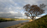
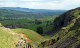
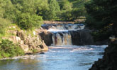
Broad upland valleys with moderately sloping valley sides, incised by narrow steep-sided gills. Alternating strata of Carboniferous limestones, sandstones and softer shales and mudstones give a gently stepped profile to the upper dale side in places. On lower slopes they are overlain by boulder clays. Hard igneous dolerites with a vertical columnar grain outcrop locally in prominent scars. Rocky fast flowing rivers and streams with braided boulder-strewn channels run through narrow floodplains of alluvium or glacial sands and gravels. Locally, outcropping dolerites form spectacular waterfalls. Soils are heavy, often waterlogged clays with more fertile brown earths on the valley floors.
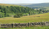
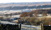
Improved and semi-improved pastures, occasionally rush-infested, and flower-rich upland hay meadows cover the valley floor and dale side. Field systems are regular or sub-regular in pattern and date largely from 18th and 19th centuries enclosures. Strong patterns of dry stone walls are prominent features of the dale-side. Walls are of locally quarried sandstones, limestones and whin stone, or rounder boulders from river beds and field clearances. Tree cover is generally sparse with scattered field and shelter trees of ash, oak and sycamore.
The middle dale is generally sparsely wooded, with narrow ash, alder or oak-birch woodlands along rivers and streams, in dale side gills or on steeper dale sides. Plantations of pine, larch or spruce are scattered across the dale side, with localised concentrations creating some heavily wooded local landscapes.
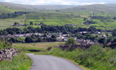
Small villages, hamlets and farm clusters follow valley floor roads. Many of these have their origins in the lead mining industry, as do many of the small farms that line the dale sides, often close to the moor wall at the limits of agriculture. Buildings are of local stone with roofs of stone flag or slate and have a strong vernacular character.
Other legacies of the lead mining industry include mine buildings, waste heaps, smelter flues, reservoirs and deep hushes which scar the dale side. Active and abandoned quarries are prominent on the dale side following outcrops of the Great Limestone and the Great Whin Sill. Large water supply reservoirs occupy a number of dales.
The landscape is visually open but enclosed by encircling moorland ridgelines. A settled and largely tranquil upland landscape that, with its vernacular buildings, field boundaries and traditionally managed meadows and pastures, has a strong sense of both visual unity and cultural continuity.
Broad Character Areas
The middle dale landscape type is represented by eight broad character areas.
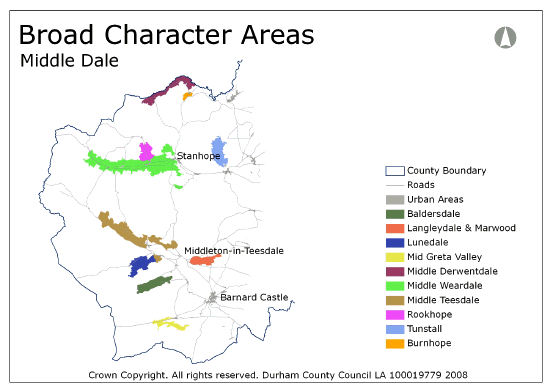
View interactive map of Broad Character Areas
Baldersdale. A narrow, shallow dale of walled pastures and meadows falling to the Blackton and Hury reservoirs. Field systems are generally old (pre-enclosure) with irregular or sub regular patterns and scattered field trees (ash), particularly in the east. The incised valley of the lower Balder contains ancient ash and oak woodland. Scattered farms, hamlets and building clusters follow the daleside roads. A visually open landscape with views across the surrounding low moors and moorland fringes.
Langleydale and Marwood. A narrow, shallow dale and associated areas of high ground lying within the ridge to the north of lower Teesdale. The head of the valley is deeply incised by gills and ravines. Improved and rushy pastures are enclosed by a regular network of stone walls and interspersed by conifer plantations and shelterbelts. A sparsely settled dale with scattered white painted farms and field barns.
Lunedale. A broad, shallow and asymmetrical dale of walled pastures and meadows lying between the high moors of Lune forest and the low plateau of Romaldkirk Moor. The northern slopes have an irregular rolling topography, incised by shallow gills, and have older field systems and frequent farms and building clusters. The southern slopes are more uniform and carry regular grids of parliamentary enclosures, straight enclosure roads and isolated farms. Grassholme reservoir occupies much of the dale floor.
Mid Greta Valley. A shallow dale of walled pastures and meadows between the low moorland plateaux of Ravock and Gilmonby moors. Field systems are generally regular, and isolated farms are strung out along the dale floor. The landscape is visually open with few trees or woodlands and is dominated in places by the busy A66.
Mid Derwentdale. A broad, shallow, and heavily wooded dale which straddles the county boundary. In the east the large Derwent reservoir occupies much of the dale floor. Parkland and estate landscapes around Ruffside Hall are heavily wooded with large blocky conifer plantations separated by large enclosures of improved pasture. Estate buildings have steeply pitched roofs and gabled upper storeys. In the west the Derwent lies in a steep sided wooded ravine with a flat and narrow floor between regular walled enclosures of improved pasture on the gently sloping dale sides above. Isolated farms are scattered along the valley roads.
Burnhope. The small shallow dale of the Burnhope Burn branches off from Derwentdale south of Edmundbyers. The Burnhope Burn carves an incised meandering course in the floor of the dale, marked in places by tree lines or narrow riverside woodlands. Improved or wet rushy pastures fall from the surrounding moors, bounded by dry stone walls and wire fences.
Mid Weardale. A broad and deep dale with a narrow dale floor. The dale is bounded by high moorland ridges divided by numerous tributary valleys. Older field systems of pastures and meadows bounded by dry stone walls are found on the south facing daleside and the dale floor. Later, more regular, enclosures are found on the higher dale side. The landscape is generally open with few trees or woodlands. Small ash and oak woodlands are found in daleside gills, and conifer plantations are scattered across the daleside. Villages, hamlets and building clusters lie along the roads of the dale floor, and isolated farms are strung out along the daleside and moorland edge. The landscape has been heavily influenced by mineral workings with many lead mining remains and active limestone quarries.
Mid Teesdale. A broad and deep dale with a broad dale floor. The southern edge of the dale is defined by Holwick Scar, an outcrop of the Great Whin Sill, which rises from the dale floor to the moorland edge. The northern slopes are divided by tributary valleys. The fast flowing and peaty River Tees flows over dramatic waterfalls at High Force and Low Force. Older field systems of dry stone walls with frequent oak and ash trees are found around pastures and hay meadows on the dale floor. Later field systems with more regular patterns are found on the northern daleside. Hamlets, farmsteads and farm clusters follow roads along the dale floor and the higher daleside. North of the Tees the white painted buildings of the Raby estate give a highly distinctive character to the dale.
Rookhope. A steep sided valley penetrating deep into ridge north of Weardale. Open walled pastures with scattered coniferous plantations fall to the Rookhope Burn, incised by narrow wooded denes. Steeper slopes along the tree-lined burn are covered by open ash woodlands. The woodlands and steep dale sides give a strong sense of enclosure in places. Isolated farms are scattered across the daleside.
Tunstall. A broad heavily wooded dale penetrating deep into Weardale’s northern ridge. Tunstall reservoir lies in its upper reaches. The western slopes fall gently to the reservoir or to the narrow dale floor, with large regular enclosures of improved pasture bounded by walls and fences, and numerous plantations, narrow gill woods and tree lines. Handsome buildings associated with the reservoir together with exotic trees in the gardens of lodges and private houses give the landscape an ordered domestic character. The eastern side has a stepped profile with large ancient oak woods, rough pasture and coniferous plantations on the lower slopes.
Local Landscape Types
Local Landscape Types and sub-types are identified at a detailed level and reflect localised variations in landscape characteristics. A map of the Local Landscape Types and sub-types for the Middle Dale Broad Landscape Type can be downloaded as a PDF below:
Local Landscape Types – Middle Dale Map (PDF, 694kb)
Alternatively you can view an interactive map of Local Landscape Types for the whole of the North Pennines County Character Area.
For a written description of the Local Landscape Type and sub-types for the North Pennines County Character Areas download the following PDF:
North Pennines Local Landscape Types (PDF, 1Mb)
Further Information
Further Broad Landscape Types with in the North Pennines
or

