Lower Dale
View interactive map of Broad Landscape Types
Key Characteristics
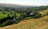
- Broad valleys with narrow floodplains or gorges on the valley floor.
- Winding, rocky fast flowing rivers.
- Carboniferous rocks covered by glacial drift, river gravels or alluvium.
- Limestones, sandstones and shales outcrop occasionally on the sides of gorges and dale side quarries.
- Heavy clay soils with more fertile brown earths and alluvial soils on the dale floor.
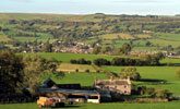
- Pastoral farmland of improved and semi-improved pastures.
- Old field systems with sub regular or linear patterns of hedges and walls.
- Relics of rig and furrow, and cultivation terraces.
- Frequent hedgerow oak, ash, sycamore and wych elm, tree lined watercourses and overgrown hedgerows
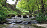
- Ancient ash and oak woods in gorges and denes.
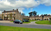
- Old villages of vernacular sandstone buildings on the dale floor.
- Scattered stone farmsteads and field barns.
- Limestone quarries are locally prominent on the dale side.
- Visually enclosed by woodlands, trees and hedgerows and defined by high moorland ridgelines.
Description
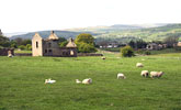
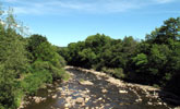
Broad upland valleys with narrow flood plains or incised gorges on the valley floor. Alternating strata of Carboniferous limestones, sandstones and softer shales and mudstones give a gently stepped profile to the dale side in places, and outcrop occasionally in gorges and dale side quarries. On lower slopes they are masked by glacial boulder clays, or sands and gravels marked by undulating terrain. Fast flowing rivers course on rocky beds through steep sided gorges or meander across floodplains of river terrace gravels and alluvium. Soils are heavy, often waterlogged clays, with more fertile brown earths and alluvial soils on the dale floor.
The lower dales are pastoral landscapes with mosaics of improved and semi-improved pasture and occasional flower-rich hay meadows. Field systems are sub-regular or linear in pattern and have their origins in the enclosure of common town fields surrounding the dales villages that took place mostly in the 17th century. Relics of ancient agriculture – rigg and furrow, lynchets and cultivation terraces – are widespread. Field boundaries are a mixture of hedgerows and stone walls. Walls are made of locally quarried stone or rounder boulders from river beds and field clearances. Hedgerows are often tall and overgrown and rich in trees, with frequent ash, oak, sycamore and wych elm. Regular parliamentary enclosures are found on more recently enclosed land on the higher dale sides.
Ancient ash and oak woodlands are found along rivers and streams and in gills and gorges. Plantations of pine and larch are scattered across the dale side. Woodland cover is not high, but the frequency of small woodlands, hedgerow and field trees, tree-lined watercourses and overgrown hedgerows gives the landscape a well-wooded feel.
Small and medium sized villages lie on the valley floor connected by winding roads. Most villages are of medieval origins and some still retain a central village green. Others were enlarged in the 18th and 19th centuries with housing for workers in the quarrying, lead mining and steel working industries. Farms and field barns are scattered across the dale side or stung out along minor roads. Buildings are of local stone with roofs of stone flag or slate and have a strong vernacular character. Active and abandoned quarries are prominent on the dale side in places following outcrops of the Great Limestone.
The landscape is relatively broad in scale, defined by encircling moorland ridgelines, but locally it is visually enclosed by woodlands, trees and hedgerows giving it a more intimate scale. A settled and largely tranquil upland fringe landscape that, with its vernacular buildings, old villages and pastoral land use, has a strong sense of both visual unity and cultural continuity.
Broad Character Areas
The Lower Dale landscape type is represented by four Broad Character Areas.
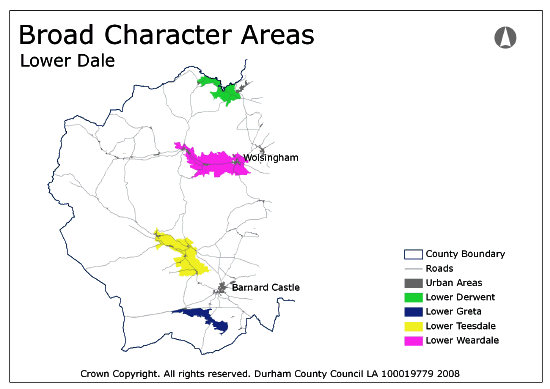
View interactive map of Broad Character Areas
Lower Derwent. The River Derwent lies in a deep, winding, gorge fed by tributaries in steep sided denes. The gorge and denes are heavily wooded, containing ancient oak and ash woodlands and conifer plantations. The surrounding valley sides are pastoral with improved or rushy pastures, irregular patterns of old hedges and walls and frequent hedgerow and field trees. The valley is sparsely settled with scattered farms in its lower reaches. The village of Edmundbyers and the hamlet of Muggleswick lie on gentle valley slopes in the west.
Lower Weardale. A broad and well-defined valley in which the River Wear meanders across a narrow floodplain flanked by narrow riparian woods and fed by small wooded gills. The landscape of the lower dale is pastoral with a mosaic of improved and semi-improved pastures, sub-regular patterns of old hedges and walls, and scattered hedgerow trees. The large villages at Wolsingham, Stanhope and Frosterley lie on the north bank of the river along the valley floor. There is a relatively dense pattern of farms, hamlets and farm clusters. The lower dale has been heavily affected by limestone quarrying with abandoned limestone quarries lining the dale between Frosterley and Stanhope. Parts of the dale are well wooded, with forestry plantations in and around old quarries and areas of former parkland.
Lower Teesdale. A broad dale with steep eastern slopes and gentle southern slopes divided by the valleys of Lunedale and Baldersdale. The River Tees meanders across a broad valley floor in the north before entering a deep wooded gorge in its lower reaches. The river and its tributaries are lined with woodlands or tree lines. The landscape is pastoral with improved and semi-improved pastures and meadows, sub regular patterns of old hedges and walls and abundant hedgerow trees. Old cultivation terraces and remnants of rig & furrow are common around the small villages found across the dale floor and the lower dale sides.
Lower Greta. A shallow dale running across the high plateau of the Stainmore Gap. The river Greta meanders across a narrow floodplain in the west before entering a narrow wooded gorge in the east. The wooded limestone scar of Kilmond Wood rises above the dale in the north. A pastoral landscape of improved and semi-improved pastures, sub regular patterns of old hedges and walls, with a linear grain in places, and scattered hedgerow trees. Farms and farm clusters are scattered along the dale.
Local Landscape Types
Local Landscape Types and sub-types are identified at a detailed level and reflect localised variations in landscape characteristics. A map of the Local Landscape Types and sub-types for the Lower Dale Broad Landscape Type can be downloaded as a PDF below:
Local Landscape Type – Lower Dale Map (PDF, 398kb)
Alternatively you can view an interactive map of Local Landscape Types for the whole of the North Pennines County Character Area.
For a written description of the Local Landscape Type and sub-types for the North Pennines County Character Areas download the following PDF:
North Pennines Local Landscape Types (PDF, 1Mb)
Further Information
Further Broad Landscape Types with in the North Pennines
or

