Lowland Vale
View interactive map of Broad Landscape Types
Key Characteristics
- Broad lowland vale.
- Varied Carboniferous and Permian rocks are covered by a thick mantle of drift.
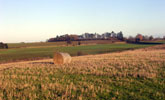
- Gently rolling or undulating topography of glacial moraines, boulder clays and sands and gravels.
- Occasional flats.
- Seasonally waterlogged loamy clay soils and more free-draining brown earths.
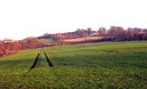
- Mixed, but predominantly arable farmland – a mosaic of improved pasture and arable cropping.
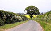
- Semi-regular patterns of old enclosures bounded by thorn hedges.
- Relics of rigg and furrow in older pastures.
- Scattered hedgerow ash, oak and sycamore – abundant in places.
- Sparsely wooded but with some heavily wooded areas of old parkland and estate farmland.
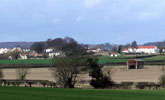
- Nucleated pattern of small green villages connected by narrow, winding, hedged lanes.
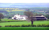
- Buildings of local stone with roofs of clay pan tile. Farms of the Raby Estate are painted white.
- The high incidence of hedgerow trees creates a degree of enclosure in places, but the landscape remains fairly broad in scale with views to distant high ground.
- A tranquil settled rural landscape.
Description
A broad lowland vale defined by higher ground to the north and south. Carboniferous and Permian rocks are overlain in most places by a thick mantle of boulder clay, morainic drift and sands and gravels. The topography is gently rolling or gently undulating with occasional flats. Soils are a patchwork of seasonally waterlogged loamy clay soils and more free-draining brown earths. In areas where the drift is absent on Permian magnesian limestones there are small pockets of calcareous brown earths.
Agricultural land use is mixed, with much of the landscape being dominated by arable cropping – primarily of cereals and oil-seed rape – but with a mosaic of pasture and arable in some areas. Field boundaries are hawthorn hedges and are usually cut low. Field patterns are semi-regular, most dating from the enclosure of the common fields of villages in the 1600s. Field systems are heavily fragmented in places by amalgamation into large arable fields. Relics of rigg and furrow are found in older, less improved pastures. There are small areas of more regular ‘surveyor enclosed’ field systems dating from the enclosure of manorial wastes in the 18th century.
Tree cover is variable with scattered hedgerow ash, oak and sycamore typical of arable farms and more abundant hedgerow trees in areas of mixed or pastoral farming. The landscape is generally sparsely wooded with occasional small broadleaved woodlands and a single example of a larger ancient oak wood. There are several heavily wooded areas of old parkland and estate farmland where parkland features such as mature field trees, avenues and park walls are found.
The landscape has a long history of settlement and a nucleated pattern of small green villages, most of Saxon or later medieval origins. Buildings are of local sandstone with roofs of clay pan tile or slate, and are set around a central village green. Between the villages lie scattered farms. Farms and farm buildings of the Raby Estate, which covers much of the northern vale, are painted white. Villages are connected by a network of narrow hedged lanes. There are occasional very small abandoned limestone and sandstone quarries worked in the past for building stone and lime.
A broad scale landscape in which the high ground of the coalfield to the north, and the Yorkshire Dales to the south, form strong middle distance horizons. Locally the high incidence of hedgerow trees creates a degree of enclosure and an intimacy of scale. Hedgerow trees are often important skyline features and help articulate and define space. A settled rural landscape.
Broad Landscape Types
The Lowland Vale landscape type is represented by two Broad Character Areas.
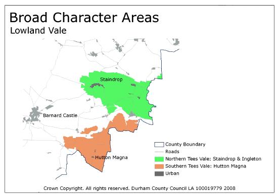
View interactive map of Broad Character Areas
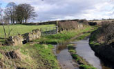
The Northern Tees Vale: Staindrop and Ingleton. Rolling, occasionally flat, farmland north of the River Tees. A patchwork of arable fields and improved pastures with old pre-enclosure field systems of clipped hawthorn hedges with scattered, locally abundant, hedgerow trees. There are areas of flat poorly drained carrs along the Langley Beck with areas of wet, rushy pasture and occasional ponds. The landscape is wooded in places with frequent broadleaved plantations. There are heavily wooded parklands and estate farmland at Raby Castle, and parklands at Selaby Park and Langton Grange. Tree lines follow minor watercourses and ditches. The large green village of Staindrop lies in the west. Smaller villages and scattered, white painted, farms in the east are connected by a network of narrow winding lanes.
The Southern Tees Vale: Hutton Magna. Gently rolling or undulating farmland in the south of the vale. An open, predominantly arable, landscape with old pre-enclosure field systems of clipped hawthorn hedges and scattered hedgerow trees. The area is sparsely wooded, with occasional small broadleaved plantations. Small hamlets and scattered farms are connected by narrow winding lanes.
Local Landscape Types
Local Landscape Types and sub-types are identified at a detailed level and reflect localised variations in landscape characteristics. A map of the Local Landscape Types and sub-types for the Lowland Vale Broad Landscape Type can be downloaded as a PDF below:
Local Landscape Types – Lowland Vale Map (PDF, 747kb)
Alternatively you can view an interactive map of Local Landscape Types for the whole of the Tees Lowlands County Character Area.
For a written description of the Local Landscape Type and sub-types for the Tees Lowlands County Character Areas download the following PDF:
Tees Lowlands Local Landscape Types (PDF, 1Mb)
Further Information
Further Broad Landscape Types with in the Tees Lowlands
or

