Upper Dale
View interactive map of Broad Landscape types
Key Characteristics
- Upper reaches of the Pennine dales.
- Varied valley topography.
- Carboniferous rocks bare of drift or covered by glacial boulder clays.
- Fast flowing rocky streams.
- Shallow, infertile or waterlogged soils.
- Wet rushy pastures, upland hay meadows and rough grazing in the moorland fringes.
- Regular field patterns of dry stone walls. Scattered field barns.
- Few trees or woodlands – occasional concentrations of conifer plantations.
- Scattered small farms with occasional farm clusters and hamlets.
- Relics of the lead mining industry – mine buildings, waste heaps, smelter flues, reservoirs and hushes.
- Major reservoirs in some dales.
- Visually open but enclosed by encircling moorland ridgelines.
- Remote and tranquil landscapes on the margins of settlement and agriculture
Description
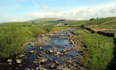
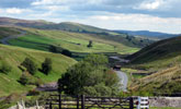
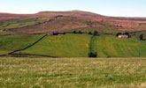
A pastoral landscape at the limits of agriculture high in the upper reaches of the Pennine dales. The topography of the dale floor in the upper dales is varied. Most upper dales are relatively shallow and broad, incised by narrow gullies – gills or sikes – cut by rocky, fast flowing streams. The underlying Carboniferous sandstones, shales and limestones are generally masked by glacial boulder clay and morainic drift. Soils are heavy waterlogged or peaty gleys.
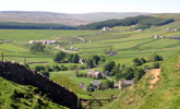
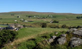
This is a pastoral landscape of wet, rush-infested pastures, upland hay meadows and rough grazing enclosed from the moor. Field patterns tend to be regular and date from enclosure and agricultural improvements from the late 18th century onwards. Fields are generally large and bounded by low dry stone walls or wire fences, often in a poor state of repair. The diversity of grasslands, grazed by hardy upland sheep and beef cattle, creates a patchwork of muted and brighter greens reflecting varying degrees of improvement by drainage, liming, and fertilising. There are scattered stone field barns and sheepfolds.
Most upper dales are open or sparsely wooded with occasional small streamside woods, sparse lines of alder trees and willow scrub following watercourses, or isolated conifer plantations or shelterbelts. In places land in the dale head has been afforested with large regular blocks of pine and spruce.
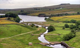
Small farms and farm clusters are scattered across the dale floor and onto the dale sides, occasionally marked by wind-blown groups of sycamore or pine shelter trees. In Teesdale the tenanted farms of the Raby estate are painted white. Many farms date from the expansion of the lead mining industry which brought miner-small holders to the limits of agriculture. Relics of the lead mining industry include derelict mine buildings, waste heaps, smelter flues, reservoirs and hushes. The heads of a number of dales are now occupied by large reservoirs.
The landscape is visually open and exposed and defined by the encircling moorland skyline. A remote and tranquil landscape on the margins of settlement and agriculture, often with a rather bleak and neglected quality.
Broad Character Areas
The Upper Dale landscape type is represented by seven broad character areas.
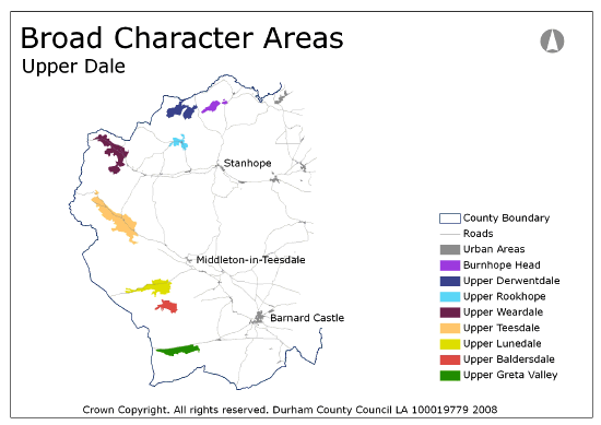
View interactive map of Broad Character Areas
Upper Derwentdale. A shallow branching dale head divided by the Nookton and Boltshope Burns. The burns are incised in steep sided gills clothed in heathland, birch woodland or conifer plantations. Walled pastures on lower ground give way to a patchwork of rougher grassland, moorland intakes and conifer plantations. The dalehead contains many lead mining remains, including the prominent smelter flue and landmark chimneys above Ramshaw. There are scattered farms and building clusters including miner’s smallholdings on the moorland edge at Boltshope Park.
Burnhope Head. Open pasture and rough grazing in the branching valley of the Burnhope Burn west of Edmundbyers. Heather moorlands sweep down to the burn in places. Old pasture woods of birch, rowan and alder lie on the northern slopes at Peddam’s Oak.
Upper Rookhope. A narrow dalehead enclosed by steep moorland slopes. The village of Rookhope lies on the narrow dale floor surrounded by walled pastures and meadows which give way abruptly to moorland. Along the valley to the west, large intakes of rough pasture merge seamlessly with the surrounding moors. The dalehead contains many lead mining remains, including the notable smelter flue arch at Lintzgarth, the Boltslaw Incline and areas of disturbed land west of Rookhope village.
Upper Weardale. A branching dalehead divided by the Burnhope, Wellhope and Killhope burns. Large conifer plantations border onto the surrounding moors and fringe the Burnhope Reservoir. Rushy pastures and meadows follow the incised valley of the River Wear. Larger intakes of rough grazing merge with the grass and heather moor of the encircling ridges. The dalehead contains many industrial remains, including the former Killhope lead mine, and has a relatively dense pattern of scattered farms and building clusters west of the village of Cowshill.
Upper Teesdale. A broad open dalehead with an undulating dale floor of walled rushy pastures and hay meadows. Large regular intakes of rough grazing rise up the daleside to the moors. White painted farms are scattered across the dale floor. The quick flowing River Tees runs below the high dolerite cliffs and screes of Cronkley Scar. A remote and dramatic landscape encircled by high moors.
Upper Lunedale. A shallow dalehead flanked by the moorland plateau of Mickleton Moor to the south and the steeper slopes of Lune Moor to the north. Selset Reservoir occupies much of the dale floor. Wet rushy pastures and larger intakes of rough grazing are incised by the gills and ravines of the Lune and its tributaries. To the south of the reservoir conifer plantations and rough grazing land fringe the open moors. A remote and austere landscape with long distance views across the moorland plateau to the south and west.
Upper Baldersdale. A small shallow dalehead largely occupied by the Balderhead reservoir. Regular walled pastures follow the northern banks of the reservoir and larger intakes of rough grazing merge gradually with the moorland plateau beyond. A remote and austere landscape with views across the moors taking in the distinctive summit of Shacklesborough to the south.
Upper Greta Valley. The shallow dalehead of the Greta valley follows the Stainmore Gap across the moorland plateau between Bowes Moor and Stainmore Forest. The course of the Greta is lined with low limestone scars in places and crossed by a natural limestone arch at God’s Bridge. A very open landscape of wet rushy pastures divided by low walls or wire fences, dominated in places by the trans-pennine A66, with distant views out across the moorland plateau.
Local Landscape Types
Local Landscape Types and sub-types are identified at a detailed level and reflect localised variations in landscape characteristics. A map of the Local Landscape Types and sub-types for the Moorland Ridges and Summits Broad Landscape Type can be downloaded as a PDF below:
Local Landscape Type – Upper Dale Map (PDF, 245kb)
Alternatively you can view an interactive map of Local Landscape Types for the whole of the North Pennines County Character Area.
For a written description of the Local Landscape Type and sub-types for the North Pennines County Character Areas download the following PDF:
North Pennines Local Landscape Types (PDF, 1Mb)
Further Information
Further Broad Landscape Types with in the North Pennines

