Moorland Plateau
View interactive map of Broad Landscape Types
Key Characteristics
- High moorland plateau.
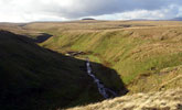
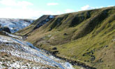
- Gently rolling, almost flat, terrain cut into by steep sided gullies.
- Occasional small, low, flat-topped, summits.
- Carboniferous rocks masked by deep peat which is exposed in eroded hags and peat edges.
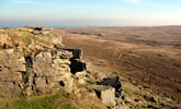
- Millstone grits outcrop locally in summits, gullies and stone bands.
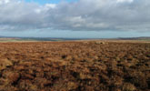
- Continuous blanket bog of heather, cotton grass and sphagnum mosses.
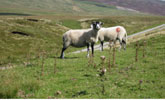
- Extensive grazing by hardy hill sheep.
- Burning patterns on grouse moors create a patchwork of older and younger heather.
- Few man made features other than occasional fences, grouse butts, cairns and sheepfolds.
- A remote and inaccessible landscape with few roads or tracks.
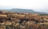
- A broad scale landscape with long distance views across open moorland to distant summits.
- An exposed, elemental and simple, often bleak, landscape with a near wilderness quality.
Description
High moorland plateau. The gently rolling, often flat, topography of the plateau is the legacy of a major ice sheet in the last glacial period. Sandstones, mudstones and shales of the Carboniferous Millstone Grit series are generally masked by a thick blanket of peat and are rarely expressed at the surface. They outcrop locally in small rocky flat-topped summits (Shacklesborough, Goldsborough) of resistant sandstones, or as screes on the sides of the narrow steep sided gullies, gills or sikes, which drain the plateau. Thick peats are exposed as dark eroding peat edges and hags.
Much of the landscape is covered by near continuous blanket bog of heather and cross-leaved heath, bilberry and crowberry, cottongrass, deergrass and bog mosses. This is replaced in the drier moorland fringes to the east by heather moorland or acid grassland. The moors are managed for grouse shooting and the extensive
grazing of hardy upland breeds of sheep like Swaledales. In places the bog has been degraded by drainage or gripping to improve its grazing potential, and this together with high stocking levels promotes a shift towards grass or sedge dominated vegetation. On grouse moors burning patterns create a patchwork of older and younger heather creating a diversity of colour and texture. Some of the wetter bogs are too wet for heather burning in most years.
The plateau is remote and inaccessible and is crossed by very few roads, tracks or footpaths. The landscape is largely devoid of man made features other than occasional fences, grouse butts and sheep folds in the more accessible moorland edges. Relics from the Bronze Age survive in a few places (Ravock Moor) in the form of cairn fields but are difficult to find in the featureless moor.
The landscape is visually open and broad in scale with panoramic views to distant summits. A remote, elemental, often bleak landscape of great simplicity with a severe climate of high rainfall, cold winters and short summers. This coupled with an almost complete absence of man-made features gives it a near wilderness quality.
Broad Character Areas
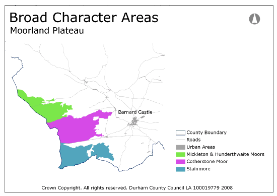
The Moorland plateau landscape type is represented by three broad character areas.
View interactive map of Broad Landscape Types
Mickleton and Hunderthwaite Moors. Extensive tracts of flat or gently rolling blanket bog incised by deep moorland gills and the valleys of the Lune and Balder. Open sweeping horizons are punctuated by low summits along the western watershed and the higher moors of Lune Forest and Mickle Fell to the north.
Cotherstone Moor. Extensive tracts of flat or gently rolling blanket bog incised by deep moorland gills. The distinctive low flat-topped summits of Shacklesborough and Goldsborough are notable features on the open sweeping horizon. The moors of Ravock contain the remains of Bronze Age cairn fields.
Stainmore. Extensive tracts of almost flat blanket bog incised by deep moorland gills. The low but pronounced moorland edge of White Brow overlooks the River Greta on Bowes Moor. The higher moorland ridge of Arkengarthdale Moor forms a strong horizon to the south.
Local Landscape Types
Local Landscape Types and sub-types are identified at a detailed level and reflect localised variations in landscape characteristics. A map of the Local Landscape Types and subtypes for the Moorland Plateau Broad Landscape Type can be downloaded as a pdf below:
Local Landscape Types – Moorland Plateau Map (PDF, 79kb)
Alternatively you can view an interactive map of Local Landscape Types for the whole of the North Pennines County Character Area.
For a written description of the Local Landscape Type and sub-types for the North Pennines County Character Areas download the following pdf:
North Pennines Local Landscape Types (PDF, 1Mb)
Further Information
Further Broad Landscape Types with in the North Pennines:
or

