Wear Lowlands
Key characteristics
- A broad lowland valley incised by the meandering River Wear and its tributaries.
- Carboniferous coal measures of sandstones, shales and coal are overlain by thick layers of glacial boulder clays, sands and gravels.
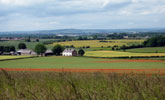
- Gently rolling terraces of open arable and mixed farmland with low hedges and few trees or woodlands occupy much of the valley floor.
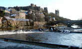
- The River Wear and its tributaries lie in steep sided wooded gorges and denes, which open up in places into broad floodplains overlooked by steep bluffs.
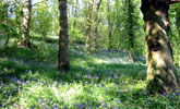
- Ancient oak woods are found in denes and gorges and steep floodplain bluffs.
- Parklands and wooded estates surrounding landmark castles and country houses lie along the river corridor.
- A settled landscape with the historic city of Durham at its centre and scattered ‘green’ villages with buildings of local sandstone with roofs of red clay pan tile or slate.
- Numerous mining or industrial towns and villages of Victorian terraced housing of brick and slate and later estate housing. Large industrial estates fringe the main settlements.
- A long-standing communications corridor carrying major roads, railways and power lines.
- Large areas of land have been opencast for coal or reclaimed from former colliery workings and their landscapes lack maturity.
- A generally broad scale landscape with panoramic views from higher ground in which Durham Cathedral is a notable landmark. In the incised valley of the River Wear the landscape is more enclosed and the scale more intimate.
- A landscape heavily influenced by urban and industrial development with a semi-rural or urban fringe character in places. Elsewhere the landscape has a strongly rural character, often of high scenic value.
Description
The lowlands of the Wear occupy a broad valley between the limestone escarpment and the spurs of Pennine fringe ridges. The River Wear carves an incised meandering course between steep bluffs and river terraces on the valley floor.
Thinly bedded sandstones, mudstones and coals of the Coal Measures are masked by thick layers of glacial drift which gives rise to a gently rolling terrain. Areas of more undulating topography mark pockets of fluvio-glacial sands and gravels. Post-glacial rivers and streams have cut down into the valley floor, creating narrow steep side gorges and denes. The floodplain of the River Wear is below the general level of the valley floor and bounded in places by steep bluffs. Soils are mostly heavy gleys with areas of lighter brown earths, sands and alluvial soils.
Agricultural land use is mixed but predominantly arable. Hedges tend to be cut low and the pattern of the landscape changes much with the seasons. Hedgerow trees are largely oak and ash and are abundant in places and sparse in others. Most field systems have their origins in town field enclosures of the 16th and 17th centuries and have suffered in varying degrees from field enlargement in the 20th centuries. There is a small surviving area of lowland heath and valley mire at Waldridge Fell.
The incised corridor of the River wear is well wooded. Ancient semi-natural oak woods are found in denes and gorges and on steep floodplain bluffs. Plantations of broadleaves or conifers like pine and larch are found in similar situations, often associated with parkland or estate landscapes. On the valley terraces woodlands are sparse. There are numerous parklands and areas of wooded estate farmland surrounding country houses and castles along the corridor of the Wear. Some are of medieval origins; others were developed in the 18th and 19th centuries.
The cathedral city of Durham occupies a strategic site in the centre of the valley. The settlement pattern is dominated by mining and industrial settlements that have built on, and in most cases entirely replaced, older agricultural villages. Old villages which retain their scale and identity are few – buildings here are typically of local sandstone with clay pan tile or slate roofs. Mining settlements are generally a mixture of 19th century terraced housing of brick and slate and post-war housing estates. Settlement edges are often abrupt or fringed by allotment gardens and pony paddocks. Large industrial estates lie on the edges of the main settlements.
The Wear Lowlands have long been an important communications corridor and carry major infrastructures such as the A1 (M), the east coast main railway line and major transmission lines, together with historic features such as disused railway lines and viaducts. The landscape has been heavily influenced by coal mining. Some elements of the older industrial landscape remain – railway lines, tramways, small waste heaps – but most have been removed by land reclamation in recent years. Opencast mining has had a substantial impact on parts of the landscape. Reclaimed or restored land is often relatively featureless and lacks maturity.
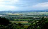
The landscape of the valley is generally broad in scale with panoramic views from higher ground in which Durham Cathedral is a notable landmark. In the heavily wooded incised valley of the River Wear the landscape is more enclosed and the scale more intimate.
The landscape has been heavily influenced by urban and industrial development and this, together with its well-developed and busy road network, gives it a semi-rural or urban fringe character in places. Elsewhere the landscape has a more rural character, often of high scenic value with numerous ornamental parklands, picturesque views and landmark buildings.
View interactive map of County Character Areas
Broad Landscape Types
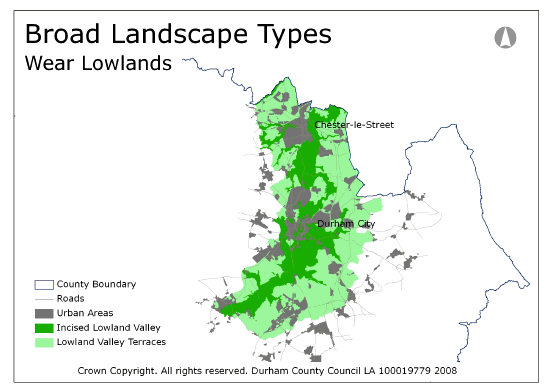
The Wear Lowlands can be broadly divided into those landscapes which are part of the heavily wooded incised valley corridor of the River Wear (Incised Lowland Valley) and those which are part of the open rolling farmland terraces to the east and west (Lowland Valley Terraces).
View interactive map of Broad Landscape Types


