Lowland Valley Terraces
View interactive map of Broad Landscape Types
Key Characteristics
- Broad lowland valley floor.
- Carboniferous Coal Measures are masked by thick layers of glacial drift.
- Gently rolling topography of boulder clay with areas of more undulating terrain of glacial sands and gravels.
- Heavy, seasonally waterlogged clay soils and lighter brown earths and brown sands.
- Mixed farmland of improved pastures and arable cropping.
- Semi-regular patterns of medium and large-scale fields bounded by low hawthorn hedges.
- Few trees – thinly scattered hedgerow ash, oak and sycamore.
- Isolated fragments of lowland heath and mire.
- Sparsely wooded but with some heavily wooded areas of old parkland and estate farmland. Scattered mining towns and villages connected by busy modern roads. Occasional older ‘green’ villages
- Opencast coal sites, clay workings and waste disposal sites locally prominent.
- Tracts of immature and relatively featureless reclaimed land. An important communications corridor with motorways, trunk roads, railway lines and overhead transmission lines.
- An open landscape, broad in scale, defined by the Limestone Escarpment to the east and the spurs of the
- West Durham Coalfield to the west.
- A settled landscape with a semi-rural or urban fringe quality in places.
Description
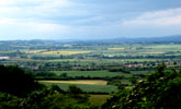
Broad lowland valley floor sitting around 40m above the level of the incised River Wear. Rocks of the Carboniferous Coal Measures are buried beneath deep layers of drift laid down over several periods of glaciation. The topography is gently rolling in areas of boulder clay with a generally more undulating terrain associated with areas of fluvio-glacial sands and gravels, and glacial moraines or kames. Watercourses are small and inconspicuous and often straightened to follow field boundaries. Soils are mostly heavy, seasonally waterlogged clays, with areas of lighter brown earths and brown sands in areas of sandier drift.
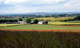
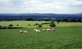
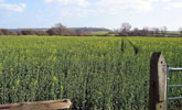
Agricultural land use is mixed but predominantly arable with a strong emphasis on cereals & oilseed rape. Field boundaries are hawthorn hedgerows – generally cut low but occasionally overgrown and neglected. Field patterns are semi-regular, most dating from the enclosure of the common fields of older villages in the 1600s. There are some areas of more regular ‘surveyor enclosed’ field systems dating from the enclosure of manorial wastes in the 1700s – often marked by the pace name ‘moor’. Field systems are often fragmented by the enlargement of arable fields. There is a single surviving area of lowland heath and mire.
Tree cover is low, with thinly scattered hedgerow ash, oak and sycamore. The landscape is generally sparsely wooded although there are some heavily wooded areas of old parkland and estate farmland with frequent conifer or mixed plantations of pine, larch and beech. Ancient and secondary semi-natural oak birch woods are found in narrow denes or along old railway lines and on former colliery land.
Mining towns and villages are scattered across the valley connected by a well-developed network of busy roads. Most of these have a core of 19th century terraced housing of brick or stone and welsh slate surrounded by estates of post-war public housing. Settlement edges are often abrupt or fringed by allotment gardens, pony paddocks and industrial land. This settlement pattern overlies and largely obscures an older network of small agricultural villages that survives in places. These older villages often have a core of buildings of local stone with roofs of clay pan tile set around a central village green.
The landscape has been heavily influenced by deep and opencast coal mining, and the extraction of clays and brickshales. Much of the legacy of the coal industry has been removed by land reclamation in recent years, but persists in the settlement pattern, in the areas of reclaimed colliery land to be found around villages, and in the well-developed network of roads, footpaths, old railway lines and waggonways. Active opencast coal sites, clay workings and waste disposal sites are locally prominent features. There are extensive areas of relatively featureless reclaimed or restored opencast land. The valley terraces have long been an important communications corridor and carry major roads, railway lines and overhead transmission lines.
The landscape is typically open in character and broad in scale. The limestone escarpment forms a middle distance horizon to the east, as do the spurs of the West Durham Coalfield to the west. Urban areas are often prominent and Durham Cathedral in its wooded setting is an important component in many views. The landscape has been heavily influenced by urban and industrial development – its scattered mining towns and villages and busy roads give it a semi-rural or urban fringe character in places.
Broad Character Areas
The Lowland Valley Terraces landscape type is represented by two Broad Character Areas.

View interactive map of Broad Character Areas
The Eastern Valley Terraces. Gently rolling farmland between the incised valley of the River Wear and the Limestone Escarpment. An open landscape of largely arable farmland with sub-regular patterns of old hedges, fragmented in places, with scattered hedgerow trees and few woodlands. The landscape becomes more wooded towards the Wear where parklands and wooded estates spread onto the terraces at Lambton, Croxdale and Whitworth. The terrace landscape runs up to the escarpment and into the escarpment vales where it becomes more wooded in places, and notable in the former parkland and estate landscapes of Elemore east of Pittingdon.
There are large areas of reclaimed colliery land and restored opencast land which contain young hedges, plantations and shelterbelts. Frequent mining towns and villages and the western outskirts of Durham City are connected by a network of busy modern highways and older, narrow, winding lanes. The area is crossed by the A1(M), the east coast main line and the Leamside line, and by major power lines. The escarpment forms a strong horizon to the east.
The Western Valley Terraces. Gently rolling or undulating farmland between the incised valley of the Wear and the valleys of the West Durham Coalfield. The terraces are incised by steep-sided wooded denes running to the Wear. Glacial sands and gravels are associated with undulating terrain which has been worked for sand in places and supports lowland heath at Waldridge Fell. An open landscape of largely arable farmland with sub-regular patterns of old hedges, fragmented in places, with scattered hedgerow trees and few woodlands. There are parklands at Brancepeth and smaller relic parklands at Sniperley, Plawsworth and The Hermitage. The landscape is heavily settled with scattered mining villages and the fringes of the larger settlements of Durham and Chester-le-Street spreading westwards onto the valley terraces. Busy roads and the east coast main line cross the area.
Local Landscape Types
Local Landscape Types and sub-types are identified at a detailed level and reflect localised variations in landscape characteristics. A map of the Local Landscape Types and sub-types for the Lowland Valley Terraces Broad Landscape Type can be downloaded as a PDF below:
Local Landscape Types – Lowland Valley Terraces Map (PDF, 917kb)
Alternatively you can view an interactive map of Local Landscape Types for the whole of the Wear Lowlands County Character Area.
For a written description of the Local Landscape Type and sub-types for the Wear Lowlands County Character Areas download the following PDF:
Wear Lowlands Local Landscape Types (PDF, 713kb)
Further Information
Further Broad Landscape Types with in the Wear Lowlands:
or


