Limestone Coast
View interactive map of Broad Landscape Types
Key Characteristics
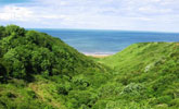
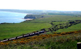
- Varied coast of shallow bays and headlands.
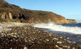
- Cliffs of pale magnesian limestone with crests of boulder clay, occasional caves and stacks.
- Sand or shingle beaches and rock platforms – despoiled in places by colliery wastes.
- Shallow denes cut down into the cliff-top boulder clay. Larger denes breach the limestone cliffs.
- Gently rolling cliff-top farmland of open arable fields or rough coastal grassland.
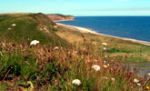
- Varied grassland flora – red fescue, sea plantain, and bloody cranesbill.
- Patches of wind-shaped blackthorn scrub with occasional hazel and juniper on clay slopes and cliff top denes.
- Ancient woodlands of ash, oak, wych elm and yew in deeper sheltered dene-mouths.
- Localised sand dunes with marram grass, sea couch and red fescue.
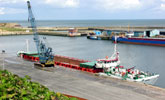
- Generally undeveloped other than the port and sea front of Seaham and localised caravan parks and recreation facilities.
- Bordered inland by the coastal railway line or the edges and allotment gardens of mining settlements.
- Areas of recently reclaimed colliery land.
- A visually open landscape with extensive views out across the North Sea.
- A natural coastline damaged in places by colliery workings and with an urban fringe quality in places.
Description
A varied coastline of shallow bays and headlands. Much of the coastline is made up of cliffs, 20 to 30 metres in height, of pale, creamy yellow Permian limestones crested by steep slopes of boulder clay, with occasional caves and stacks. The limestones exposed in the cliffs vary in character and include soft dolomites, thinly bedded or “brecciated” by the collapse of underlying strata, oolithic and concretionary limestones, and fossil-rich reef limestones.
The foreshore is made up of beaches of sand and shingle or cobbles with occasional wave-cut rock platforms. Beaches are despoiled in places by the past tipping of colliery wastes, now being gradually eroded by the sea. Shallow denes cut down into the cliff-top boulder clay and the mouths of larger inland denes breach the limestone cliffs. In the south, low sand dunes bound by marram grass and sea couch mark the transition with the lower lying coastal plain.
Above the cliffs lie relatively flat or gently rolling open arable fields and rough coastal grasslands. These grasslands, and those on the clay slopes, have a varied flora of red fescue, sea plantain and bloody cranesbill. Patches of wind-shaped blackthorn scrub with occasional stunted hazel and juniper are found on clay slopes and cliff top denes. Ancient woodlands of ash, oak, wych elm and yew lie in the deeper and more sheltered dene-mouths.
The coastline has no natural anchorages and is relatively undeveloped. There is a single working port at Seaham, which also has a developed sea front, and there are caravan sites in the south at Crimdon. It is bordered inland by the coastal railway line and by the edges of mining settlement. Allotment gardens and industrial estates spill onto the coast in places. There are areas of recently reclaimed colliery land, restored to open grassland.
The landscape is exposed and visually open with extensive panoramic views out across the North Sea, and dramatic scenic views along the coastline. It has natural and elemental qualities, coming from its geology, its semi-natural vegetation and the influences of the sea, but has a despoiled or urban fringe quality in places.
Broad Character Areas
The Limestone Coast landscape type is represented by a single Broad Character Area: The Durham Coast.
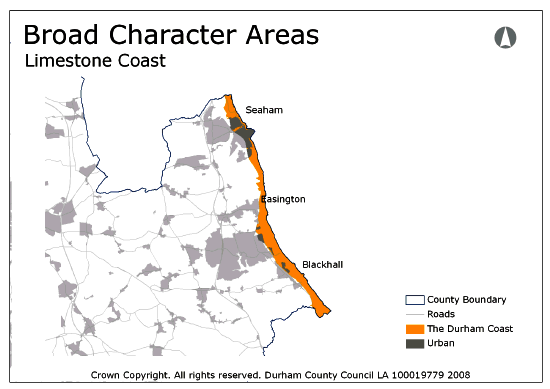
View interactive map of Broad Character Areas
Local Landscape Types
Local Landscape Types and sub-types are identified at a detailed level and reflect localised variations in landscape characteristics. A map of the Local Landscape Types and sub-types for the Limestone Coast Broad Landscape Type can be downloaded as a PDF below:
Local Landscape Types – Limestone Coast Map (PDF, 570kb)
Alternatively you can view an interactive map of Local Landscape Types for the whole of the East Durham Limestone Plateau County Character Area.
For a written description of the Local Landscape Type and sub-types for the East Durham Limestone Plateau County Character Areas download the following PDF:
East Durham Limestone Plateau (PDF, 1Mb)
Further Information
Further Broad Landscape Types with in the East Durham Limestone Plateau
or
- Broad Landscape Type Guidelines – Limestone Coast
- County Character Areas
- Broad Landscape Types
- Local Landscape Types
Go back to East Durham Limestone Plateau County Character Area

