Coastal Limestone Plateau
View interactive map of Broad Landscape Types
Key Characteristics
- Low coastal plateau of rolling terrain, incised by narrow steep-sided denes.
- Gently rounded topography of soft magnesian and shell limestones covered in places by glacial drift of boulder clay, sands and gravels.
- Heavy, seasonally waterlogged clay soils and lighter brown earths.
- Predominantly arable farmland of cereals and oilseed rape.
- Semi-regular patterns of medium and large-scale fields bounded by low hawthorn hedges.
- An open landscape exposed to the sea with few trees or woodlands.
- Ancient ash woods in sheltered denes.
- Large mining towns and villages connected by a well-developed network of busy roads.
- Scattered older agricultural ‘green’ villages connected by narrow winding lanes.
- Occasional areas of parkland and estate farmland rich in hedgerow trees.
- A visually open landscape, broad in scale but with spaces defined by the rolling terrain.
- The sea is often visible forming the eastern horizon.
- A semi-rural or urban fringe quality in places.
Description
A low coastal plateau of gently rolling terrain, incised by narrow steep sided denes. Soft magnesian limestones (dolomites) and shell or reef limestones are overlain generally by glacial drift of boulder clays and sands and gravels. Soils are heavy, seasonally waterlogged brown stony clay soils with pockets of lighter calcareous soils where there is no drift, and fertile brown earths over deposits of sands and gravels.
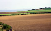
Agricultural land use is largely arable and dominated by cereals and oilseed rape. Field boundaries are low, clipped, hawthorn hedges. Field patterns are semi-regular, and most date from the enclosure of the town fields of older villages in the 1600s. Field patterns have been heavily disrupted in places by the amalgamation of smaller units into very large arable fields.
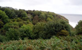
Tree cover is generally very low with only isolated hedgerow ash or sycamore. There are, however, localised areas of parkland and estate farmland that is rich in hedgerow and field trees. The landscape is generally very open and exposed to the strong, salt laden winds and sea frets of the North Sea. Woodlands are almost entirely restricted to the sheltered denes that contain ancient woodlands of ash, oak, wych elm and yew.
Historically a settled landscape with a nucleated pattern of small agricultural villages of early medieval origins. A number of these survive and most have buildings of local limestone, or more durable sandstone imported from the west of the county, and roofs of red clay pan tile. Buildings are typically set around a central green. Old villages and scattered farms are connected by narrow winding roads and lanes.
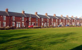
The new town of Peterlee and large mining villages developed around major coastal collieries occupy a substantial part of the coastal plateau. They are made up of buildings from a number of periods including Victorian terraced housing of red brick and slate, estates of the inter-war and post-war public housing and more recent private development. Settlement edges are abrupt or fringed by allotment gardens and pony paddocks or large industrial estates.
Coal mining has had a substantial influence on the landscape, its main legacy being in the settlement pattern. Extensive areas of colliery land are currently being reclaimed to housing and industry. The coastal plateau is an important communications corridor and is crossed by the busy A19 trunk road and the coastal railway line.
The landscape is visually open and broad in scale, with spaces defined by the rolling topography. The sea is often visible, forming a strong distant horizon to the east. A densely settled landscape with a semi-rural or urban fringe quality in many places, but with a strongly rural character in some areas.
Broad Character Areas
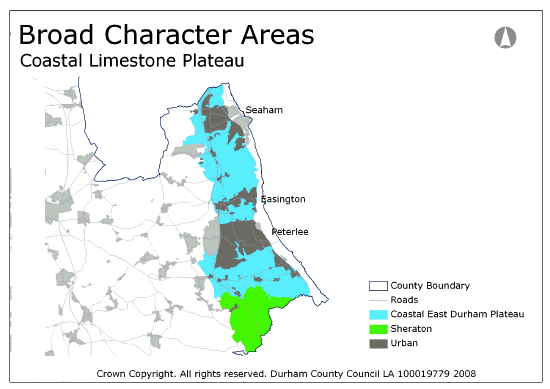
The Coastal Limestone Plateau landscape type is represented by two Broad Character Areas.
View interactive map of Broad Character Areas
The Coastal East Durham Plateau. A rolling plateau incised in places by narrow denes. A densely settled landscape dominated by the towns of Peterlee, Seaham and Easington Colliery. Between the settlements lie open arable farmlands with low hedges and few trees. The denes are heavily wooded and contain ancient ash woods and mixed plantations; woodlands are largely absent elsewhere. South of Peterlee the estate farmland of Castle Eden is rich in hedgerow trees. The busy A19 trunk road runs along the boundary of the character area in the west.
Sheraton. An undulating coastal plain, transitional in character between the Coastal Limestone Plateau and the Lowland Plain to the south, and extending outside of the county to the south and east. The terrain is for the most part gently undulating, though strongly undulating in places, forming discrete low hills. A predominantly arable landscape with old pre-enclosure hedgerow networks, locally heavily fragmented, and few hedgerow trees. The area is crossed by the busy A19 in prominent cuttings and embankments. There are occasional small broadleaved woodlands on prominent hill-tops and large ancient woodlands in incised denes. The deserted medieval village of Sheraton with associated areas of rig and furrow pasture lies beside the A19.
Local Landscape Types
Local Landscape Types and sub-types are identified at a detailed level and reflect localised variations in landscape characteristics. A map of the Local Landscape Types and sub-types for the Coastal Limestone Plateau Landscape Type can be downloaded as a PDF below:
Local Landscape Types – Coastal Limestone Plateau Map (PDF, 851kb)
Alternatively you can view an interactive map of Local Landscape Types for the whole of the East Durham Limestone Plateau County Character Area.
For a written description of the Local Landscape Type and sub-types for the East Durham Limestone Plateau County Character Areas download the following PDF:
East Durham Limestone Plateau (PDF, 1Mb)
Further Information
Further Broad Landscape Types with in the East Durham Limestone Plateau
or

