East Durham Limestone Plateau Assets and Attributes
Landscape Designations
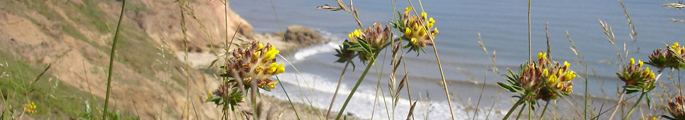
Parts of the Durham Coast along with wooded landscapes around Castle Eden, Wingate and Ellemore, are designated as Areas of High Landscape Value (AHLV) in Local Plans. Much of the coast is designated as Heritage Coast.
- View Landscape Designations map
International Nature Conservation Designations
Parts of the coast, together with Castle Eden Dene and Thrislington National Nature Reserves, are designated as Special Areas for Conservation (SAC)
National and Local Nature Conservation Designations
The area contains a relatively large number of Sites of Special Scientific Interest (SSSI) including magnesian limestone grasslands, abandoned limestone quarries and ancient ash and yew woodlands. A large number of similar habitats are designated as County Wildlife Sites – many on the disturbed sites of old quarries and mine workings, railway lines, road verges and clay pits.
Biodiversity Action Plan Priority Habitats and Species
The landscape is important for a number of national and local Biodiversity Action Plan priority habitats and species. Priority habitats in the Durham Biodiversity Action Plan (DBAP) represented in the Limestone Plateau include:
- Ancient Semi Natural Woodland
- Other Broadleaved Woodland
- Native Hedgerows
- Parkland
- Scrub
- Veteran Trees
- Wet Woodland
- Lowland Fen Habitats
- Phragmnites Australis Reedbed
- Ponds
- Rivers and Streams
- CG8 Grassland
- Coastal Soft Cliffs and Slopes
- Early Succesional Brownfield Land
- Lowland Heath
- Lowland Meadows and Pasture
- Magnesian Limestone Grassland
- Strandline
- Road Verges of Conservation Importance
- Waxcap Grasslands
Priority species in the Durham Biodiversity Action Plan (DBAP) found in the Limestone Plateau include:
- Badger
- Bats
- Brown Hare
- Harvest Mouse
- Hedgehog
- Otter
- Water Vole
- Barn Owl
- Corn Bunting
- Curlew
- House Sparrow
- Lapwing
- Linnet
- Little Tern
- Purple Sandpiper
- Redshank
- Reed Bunting
- Roseate Tern
- Sanderling
- Skylark
- Snipe
- Song Thrush
- Starling
- Tree Sparrow
- Yellow Wagtail
- Common Lizard
- Slow Worm
- Great crested Newt
- Chalk Carpet Moth
- Cistus Forester (moth)
- Dark Green Fritillary
- Dingy Skipper
- Glow Worm
- Grayling
- Least Minor (moth)
- Northern Brown Argus
- White-letter Hairstreak
- Juniper
Habitat Networks
Semi-natural habitats occupy a relatively small proportion of the Limestone Plateau. The majority of grasslands are improved with scattered patches of magnesian limestone grassland associated with limestone outcrops or old quarries. There is a more continuous, through often very narrow, corridor of semi-natural grassland along the coast. The woodland network is heavily fragmented with woods largely confined to incised coastal denes, which are isolated from each other, and occasional steep slopes on the escarpment. Many woods have been re-stocked, which can affect their network value for some species – as can their generally small scale. Early successional brownfield land occurs in both isolated pockets and in linear corridors following former railways. Wetland habitats occur generally as small and isolated features. The poor condition of some wetlands – notably stocking with fish – affects their network value for some species. The overall pattern of habitat distribution closely reflects the topography, with most semi-natural habitats found along incised denes, coastal slopes and escarpment spurs, separated by extensive areas of intensive farmland or built development.
- View Habitat Network Map
Ancient Semi-natural Woodlands
Ancient semi-natural woodlands are sparse on the East Durham Plateau but it contains notable ancient ash, or ash and yew, woods in the denes of the coastal plateau and on the steeper slopes of the escarpment.
- View Ancient Woodland Map
Earth Heritage Designations
The area contains a number of Geological/Geomorphological Sites of Special Scientific Interest (SSSI) and County Geological/Geomorphological Sites (now known as Local Geological Sites). These include natural and man-made exposures of the Permian limestones and sands on the coast and in quarries, road and railway cuttings, together with glacial features including kames and melt-water channels.
Archaeological Sites and Monuments
The area contains archaeological remains from the Neolithic period onwards, many of which are recorded in the Durham Sites and Monuments Record (SMR). Features from most periods are concentrated along the coast and the escarpment. Scheduled Ancient Monuments include a large number of deserted medieval settlements.
Built Heritage
Some of the older settlements of the East Durham plateau are designated as Conservation Areas. The landscape is not particularly rich in listed buildings but contains a wide variety, from mediaeval park walls to colliery buildings.
- View Built Heritage Map
Historic Parks and Gardens
There are a small number of relic historic parklands in the area. Parkland at Castle Eden is included on English Heritage’s Register of Parks and Gardens of Special Historical Interest, as is small modern urban parkland in Peterlee new town.
- View interactive Registered Parks and Gardens Map
Access and Recreation
The area has a well-developed network of public rights of way, associated with older agricultural villages and later mining settlements. Some areas of the Clay Plateau, which historically were less densely settled, are poorly accessed. Major recreational path include the Haswell to Hart and Castle Eden walkways, both developed from abandoned railway lines, and the new coastal path.
Water Resources
The limestone of the plateau is a major aquifer providing drinking water for communities in East Durham and Sunderland to the north. Much of the area is designated as a Source Protection Zone. Water quality in most of the watercourses is poor as a result of discharges from mine workings, sewage treatment works, storm sewage overflows, and surface water drainage from industrial and agricultural activities. Parts of the area are designated as a Nitrate Vulnerable Zone.
- View Water Resources Map
Agricultural Land Classification
Agricultural land on the plateau is for the most part Grade 3a (moderate) and 3b (good) with small pockets of Grade 2 (very good).