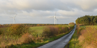
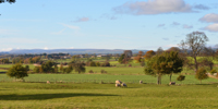
County Durham Landscape Character
Landscape character is the recognisable pattern of elements that occurs in a particular landscape. Variations in geology and soils, landform, land use and vegetation, field boundaries, settlement patterns and building styles, give rise to different landscapes each with its own distinctive character and unique sense of place.
The diversity of landscape character across the county has been mapped in the County Durham Landscape Character Assessment which was formally adopted in 2008.
The The Durham Landscape sections give more information on the landscape of the county including the physical and human influences that have shaped it, the patterns of land use and landscape features present in the modern landscape, the environmental designations affecting the landscape, and current and past perceptions of the landscape. Whilst the Character Overview section gives information on the landscape character assessment, how it was carried out, and the way in which it classifies the landscape. Descriptive information on County Character Areas, Broad Landscape Types, Local Landscape Types and Subtypes can be found in the Character Areas and Types Section.
Downloads
The County Durham Landscape Character Assessment 2008 can also be downloaded below:
County Durham Landscape Character Assessment 2008: Introduction (PDF, 918kb)
County Durham Landscape Character Assessment: The Durham Landscape (PDF, 1Mb)
County Durham Landscape Character Assessment: Classification (PDF, 716kb)
County Durham Landscape Character Assessment: The North Pennines (PDF, 2Mb)
County Durham Landscape Character Assessment: The Dales Fringe (PDF, 1015kb)
County Durham Landscape Character Assessment: The West Durham Coalfield (PDF, 1Mb)
County Durham Landscape Character Assessment: The Wear Lowlands (PDF, 1017kb)
County Durham Landscape Character Assessment: The East Durham Limestone Plateau (PDF, 1Mb)
County Durham Landscape Character Assessment: The Tees Lowlands (PDF, 1Mb)


