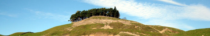
Landscape Classification
The County Durham Landscape Character Assessment identifies landscape types and character areas at three different levels – the regional, the sub-regional and the local landscape types.
- Regional – County Character Areas
- Sub-regional – Broad Landscape Types and Broad Character Areas
- Local – Local Landscape Types and Local Sub-types
Download the following PDFs for further information.
County Durham Regional and Sub-Regional Landscapes (PDF, 32kb)
County Durham Local Landscape Type (PDF, 68kb)
County Character Areas
County Character Areas are based on Natural England’s Countryside Character Areas. There are 6 Countryside Character Areas in County Durham, all of which extend beyond its administrative boundaries. County Character Areas are effectively those parts of Countryside Character Areas lying within the County. The boundaries of County Character Areas are more precisely drawn than those of Countryside Character Areas as they are based on a more detailed level of assessment. In reality the boundaries between these broad landscape zones are often gradual and progressive and difficult to identify precisely on the ground. The character of County Character Areas may differ in some ways from that of the larger Countryside Character Areas to which they belong. The descriptions of County Character Areas given here in the Landscape Assessment may therefore be slightly different to the descriptions given in other publications for Countryside Character Areas.

Broad Landscape Types and Character Areas
Broad Landscape Types
Broad Landscape Types are landscapes with similar patterns of geology, soils, vegetation, land use, settlement and field patterns identified at a broad sub-regional level. As with County Character Areas, the boundaries between Broad Landscape Types are not always precise, as the change between one landscape and another can be gradual and progressive. Landscapes belonging to a particular type – for example an ‘Upper Dale’ landscape – may be found in many different places.

Broad Character Areas
Broad Character areas are unique areas – geographically discrete examples of a particular landscape type. For example Upper Teesdale is a character area belonging to the Upper Dale type. In some cases character areas are physically separate landscapes – as they are in the Upper Dales and the Coalfield Valleys – in other cases larger tracts of landscape have been broken down into a number of character areas where this was the best way of accounting for variations in character within the broad type.
Local Landscape Types and Subtypes
Local Landscape Types and Subtypes are tracts of land which share similar combinations of soils, land use, field boundaries and tree and woodland cover. Some Local Landscape Types may be found in only one Broad Landscape Type; others may be found across a wider range of landscapes.
Local Landscape Sub-types are used to identify variations within a local landscape type. For example landscapes belonging to the type ‘Valley farmland: pasture’ may include some examples with early post-medieval field systems (subtype: old enclosure) and some with parliamentary enclosure field systems (subtype: surveyor-enclosed). Local subtypes are not listed separately here but are described within the sections dealing with local landscape types.
View Interactive Map of Local Landscape Types by County Character Area: