Dales Fringe Assets and Attributes
Landscape Designations
The greater part of the Dales Fringe is designated as an Areas of High Landscape Value (AHLV) in the Teesdale Local Plan.
- View Landscape Designations map
International Nature Conservation Designations
None.
National and Local Nature Conservation Designations
The area contains a single Sites of Special Scientific Interest (SSSI) at Brignall Banks woods. A number of woodlands along the River Tees, together with parklands at Rokeby and Lartington, are designated as County Wildlife Sites (now known as Local Wildlife Sites).
Biodiversity Action Plan Priority Habitats and Species
The landscape is important for a number of national and local Biodiversity Action Plan priority habitats and species.
Priority habitats in the Durham Biodiversity Action Plan (DBAP) represented in the Dales Fringe include:
- Ancient Semi Natural Woodland
- Other Broadleaved Woodland
- Native Hedgerows
- Parkland
- Scrub
- Veteran Trees
- Wet Woodland
- Wood Pasture
- Exposed Riverine Sediments
- Ponds
- Rivers and Streams
- Species-rich Upland Acid Grassland
- Road Verges of Conservation Importance
- Waxcap Grasslands
Priority species in the Durham Biodiversity Action Plan (DBAP) found in the Dales Fringe include:
- Badger
- Bats
- Brown Hare
- Harvest Mouse
- Hedgehog
- Otter
- Water Vole
- Barn Owl
- Black Grouse
- Curlew
- House Sparrow
- Lapwing
- Linnet
- Nightjar
- Redshank
- Reed Bunting
- Skylark
- Snipe
- Song Thrush
- Spotted Fly-catcher
- Starling
- Tree Sparrow
- Common Lizard
- Slow Worm
- Great crested Newt
- Eel
- Salmon
- Trout
- Dingy Skipper
Habitat Networks
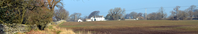
Semi-natural habitats occupy a small proportion of the Dales Fringe. The majority of grasslands are improved with small and thinly scattered pockets of semi-improved pasture. The woodland network is more robust with fairly well connected riparian corridors of woodland along the Tees and some of its tributaries, and localised areas of heavily wooded estate landscapes. There are substantial gaps in the network and many woods have been re-stocked which can affect their value as networks for some species, as can their generally small scale. The overall pattern of habitat distribution closely reflects the topography, with most woodland habitats found along the incised corridors or rivers and streams separated by extensive areas of agricultural land.
- View Habitat Network Map
Ancient Semi-natural Woodlands
Ancient semi-natural woodlands are found occasionally in steep sided denes and along the banks of rivers and streams, and particularly the River Tees and its larger tributaries.
- View Ancient Woodland Map
Earth Heritage Designations
None.
Archaeological Sites and Monuments
The landscape contains archaeological remains from the Neolithic period onwards, many of which are recorded in the Durham Sites and Monuments Record (SMR). Scheduled Ancient Monuments range from prehistoric rock art to the remains of the medieval abbey at Egglestone.
Built Heritage
Most of the older settlements in the Dales Fringe are designated as Conservation Areas. The rural landscape contains a wide variety of listed buildings ranging from domestic and agricultural buildings to monastic buildings, castles and country houses.
- View Built Heritage map
Historic Parklands
The Dales fringe is notable for its historic parks and gardens, four of which (Raby, Rokeby, Lartington and Bowes Museum) are on English Heritage’s Register of Parks and Gardens of Special Historic Interest.
- View interactive Registered Parks and Gardens Map
Access, Recreation and Tourism
Public rights of way are relatively sparse over much of the Dales Fringe and largely absent from some estate landscapes. The long distance Teesdale Way follows the course of the river. The former Barnard Castle branch of the North Eastern Railway is awaiting development as a railway walk. Tourism is increasingly important to the local economy. There are important visitor attractions at Bowes Museum and Egglestone Abbey.
Water Resources
Water quality in the River Tees and its tributaries is generally good throughout the area.
- View Water Resources Map
Agricultural Land Classification
Much of the Tees Vale is Grade 3a (good) or 3b (moderate) agricultural land. The higher ground of the Upland Fringes are generally of Grade 4 (poor).