Dales Fringe
Key Characteristics
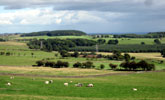
- A broad rolling vale in which the River Tees carves an incised course between the valleys of its tributaries.
- Carboniferous millstone grits and limestones are masked by glacial or alluvial drift and outcrop only rarely in incised denes or steep valley side bluffs.
- Pastoral farming on heavy clay soils in the upland fringes gives way to mixed and arable farming on more fertile brown earths on lower ground.
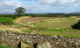
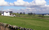
- Higher pastures in the upland fringes have regular patterns of parliamentary enclosures bounded by hedges and dry stone walls with scattered farms linked by straight enclosure roads.
- The lower farmland of the vale has a smaller scale pattern of irregular hedged or walled fields with frequent ash and oak trees, and a nucleated settlement pattern of old villages connected by winding lanes.
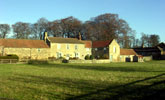
- Buildings are typically of local stone with roofs of stone flag or slate. North of the Tees the farms of the Raby estate are painted white.
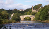
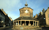
- The historic market town of Barnard Castle lies on the Tees in the centre of the vale.
- Ancient oak and ash woods lie in steep sided denes and riverside bluffs along the Tees and its southern tributaries. Conifer plantations are scattered across the upland fringes.
- Historic parklands and wooded estates surround a number of country houses including the landmark Raby Castle.
- The valleys of the Tees and Greta are a long established trans-pennine communications corridor and carry the A66 and a number of abandoned railway lines.
- A generally broad scale landscape with panoramic views from higher ground across the vale though locally more intimate in scale in more wooded areas.
- An essentially rural landscape with little urban or industrial development.
Description
The River Tees carves an incised course in the centre of a broad vale. The northern flanks of the vale are occupied by the shallow valleys of the Langley and Sudburn becks that run parallel with the Tees. To the south the upland plateaux of the Stainmore Gap falls gradually to the River, incised by the steep sided valleys and denes of its southern tributaries.
The Carboniferous millstone grits and limestones that make up the vale are largely masked by thick layers of glacial and alluvial drift and outcrop only occasionally on steeper valley sides. Soils are a mixture of heavy gleys derived from glacial boulder clays and more fertile brown earths on sands and gravels on the vale floor.
The landscape is transitional in character lying between the pastoral landscapes of the dales and the arable lowlands to the east. On higher less fertile ground land use is largely pastoral. Regular patterns of hedges and stone walls date from parliamentary enclosures of upland wastes in the 18th and 19th centuries and are crossed by straight roads connecting scattered farms. Lower lying land has a long history of mixed farming and has a nucleated settlement pattern of small villages of medieval origins connected by narrow winding lanes. Sub-regular patterns of walls and hedges, often rich in hedgerow oak and ash, date from the enclosure of the open fields of these villages in the 17th century.
Buildings are typically built of local stone with roofs of stone flag or welsh slate. North of the Tees the farms and buildings of the Raby estate are painted white. The historic market town of Barnard Castle lies beside the Tees in the centre of the vale. There are numerous parklands, many of which are medieval in origin, surrounding country houses and castles, the most notable of which is Raby Castle on the northern flanks of the vale.
Ancient semi-natural woods of ash and oak are found on steeply sloping sites along the Tees and its tributaries, in ravines and gorges, steep riverside bluffs and narrow linear denes. Scattered conifer plantations are characteristic of the upland fringes.
The vale floor and the Stainmore Gap to the west are long established communications corridors. The A66 follows the trans-pennine course of a Roman military road. There are many abandoned railway lines, some now in use as cycleways. There are occasional small sandstone quarries producing building stone and larger road stone quarries working the Great Limestone close to the A66.
The landscape is generally broad in scale with panoramic views across the vale and west into Teesdale. The high ridges of the Pennine Uplands form the enclosing view line to the south and the high ground of the Tees/Wear watershed to the north. Locally the landscape is more intimate in scale and particularly in the more wooded or tree rich landscapes of the lower vale.
The landscape is essentially rural in character with little urban or industrial development.
View interactive map of County Character Areas
Broad Landscape Types
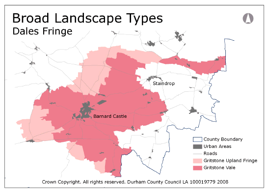
The landscape assessment divides the landscapes of the Dales Fringe into two broad types. On high ridges and plateaux, and merging with the moorland fringes of the North Pennines, the Gritstone Upland Fringe covers pastoral landscapes enclosed in the 18th and 19th centuries with regular patterns of walls and hedges, straight enclosure roads and isolated farms.
The lower ground of the Gritstone Vale has a longer history of settlement with a strongly nucleated pattern of small villages connected by winding lanes and surrounded by fields enclosed largely in the 16th and 17th centuries, which had previously been their common town fields or early enclosures from the wastes. Agricultural land use here is a mosaic of pastoral and arable farmland, with a strong pastoral emphasis on higher ground bordering the Upland Fringe.
View interactive map of Broad Landscape Types


