Gritstone Vale
View interactive map of Broad Landscape Types
Key Characteristics
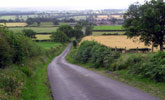
- Broad rolling vale, incised by the narrow denes of rivers and streams
- Gently rounded topography of thinly bedded sandstones, limestones and mudstones overlain by glacial drift.
- Mosaic of heavy, seasonally waterlogged clay soils and more fertile brown earths.
- Mixed farmland of improved pasture and arable cropping.
- Semi-regular, sometimes linear, patterns of old enclosures bounded by thorn hedges, with occasional dry stone walls.
- Abundant hedgerow ash, oak and sycamore.
- Ancient ash and oak woodlands in narrow denes. Scattered coniferous or mixed plantations.
- Areas of old parklands and heavily wooded estate farmland.
- Nucleated settlement pattern of small green villages centered on the historic market town of Barnard Castle. Scattered farms.
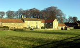
- Buildings of local stone with roofs of stone, slate or clay pan tile. Farms of the Raby Estate painted white.
- Narrow winding lanes and some busy modern highways.
- Occasional disused army camps.
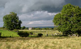
- A well timbered landscape creating a high degree of enclosure in places, but with broad scale panoramic views across the vale from higher vantage points.
- A tranquil settled rural landscape.
Description
A broad rolling vale, made up of the valleys of the river Tees and its tributaries. Rivers and streams are incised in narrow steep sided denes. A thick mantle of glacial drift made up of boulder clays and sands and gravels overlies thinly bedded Carboniferous limestones, sandstones and mudstones. The resulting soils are a mosaic of heavy, seasonally waterlogged clays and more fertile and free draining brown earths.
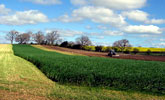
Agricultural land use reflects the underlying variety of soils with a mixture of improved pasture and arable cropping – mostly of cereals and oil-seed rape. There is a strong pastoral emphasis on higher ground bordering the Upland Fringe. Field boundaries are largely hedgerows, with occasional dry stone walls. Hedges tend to be dominated by hawthorn, with blackthorn and holly common – trimmed in arable areas but often leggy and overgrown in pastoral areas.
Field systems are semi-regular in pattern, most dating from the enclosure of common fields of villages in the 16th and 17th centuries. Some hedges retain the sinuous shapes of arable strips. Relics of medieval cultivation in the form of rigg and furrow, and lynchets – are common in older, less improved, pastures. There are small areas of more regular ‘surveyor enclosed’ field systems dating from the enclosure of manorial wastes in the 18th century.
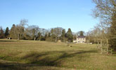
The landscape is rich in trees with abundant hedgerow ash, oak and sycamore. In places it is well wooded, with ancient ash and oak woodlands in narrow denes along rivers and streams, and scattered coniferous or mixed plantations. The vale contains a number of historic parklands on ancient sites and areas of heavily wooded estate farmland. Set within these are imposing country houses and castles.
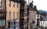
The landscape has a long history of settlement and a nucleated pattern of small green villages, most of Saxon or later medieval origins, centered on the historic market town of Barnard Castle. Buildings are of local sandstone with roofs of stone flag, welsh slate, or less frequently clay pan tile, and are set around a central village green. Between the villages lie scattered farms. Those of the Raby Estate, which covers much of the northern vale, are painted white. Villages are connected by a network of narrow hedged lanes.
The vale has long been an important communications corridor and carries a number of busy modern roads, as well as some long abandoned railway lines. There are a number of disused army camps dating from the mid 20th century.
A well timbered landscape creating a high degree of enclosure in places, but with broad scale panoramic views across the vale from higher vantage points. A tranquil, settled, rural landscape with a strong sense of cultural continuity.
Broad Character Areas
The Gritstone Vale landscape type is represented by five Broad Character Areas.
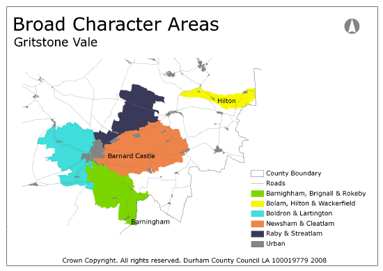
View interactive map of Broad Character Areas
Barningham, Brignal and Rokeby. Gently sloping farmland on the southern flanks of the Tees Vale. A patchwork of arable fields and improved pastures is defined by sub-regular patterns of old hedgerows with scattered hedgerow oak, ash and sycamore. There are frequent small plantations of conifers or broadleaves. The River Tees is lined by low wooded bluffs or narrow riparian woods. Its tributaries, including the River Greta, lie in narrow steep-sided denes containing ancient ash and oak woodlands. There are historic parklands along the lower Greta at Rokeby Eastwood Hall, and remains of a medieval abbey at Egglestone. The small villages of Barningham and Brignal lie on the upper vale side.
Bolam, Hilton and Wackerfield. Gently sloping farmland on the edges of the Hummerbeck plateau overlooking the Tees Vale. A patchwork of arable and pastoral farmland with sub-regular patterns of clipped hedgerows and dry stone walls with scattered oak, ash and sycamore trees. Small agricultural villages and hamlets are connected by narrow winding lanes. The farms and farm buildings of the Raby Estate are painted white.
Boldron and Lartington. Gently sloping farmland falling from the fringes of the moorland plateau to the River Tees. A pastoral landscape of improved and semi-improved pastures bounded by old hedges and walls with scattered, locally abundant, hedgerow trees. The River Tees is lined by steep wooded bluffs; its tributaries, including the Deepdale Beck, lie in narrow steep-sided denes containing ancient ash and oak woodlands. The small villages of Boldron, Lartington and Cotherstone lie on the upper slopes of the vale. There are historic parklands at Lartington.
Newsham and Cleatlam. Gently rolling or undulating farmland in the floor of the vale east of Barnard Castle. A patchwork of arable and pastoral farmland with sub-regular patterns of clipped hedgerows and occasional dry stone walls with frequent oak, ash and sycamore and scattered plantations. Small hamlets and farms are connected by narrow winding lanes. The farms and farm buildings of the Raby Estate are painted white.
Raby and Streatlam. Gently rolling farmland in the floor of the vale and the lower reaches of the Langley Beck valley north of Barnard Castle. A pastoral landscape of improved pasture with sub-regular patterns of clipped hedgerows and scattered hedgerow oak, ash and sycamore. An open landscape with occasional small plantations. The estate farmland of Raby Park in the north is more heavily wooded. There are historic parklands at Raby and Streatlam. Scattered farms and farm buildings of the Raby Estate are painted white.
Local Landscape Types
Local Landscape Types and sub-types are identified at a detailed level and reflect localised variations in landscape characteristics. A map of the Local Landscape Types and sub-types for the Gritstone Vale Broad Landscape Type can be downloaded as a PDF below:
Local Landscape Types – Gritstone Vale Map (PDF, 887kb)
Alternatively you can view an interactive map of Local Landscape Types for the whole of the Dales Fringe County Character Area.
For a written description of the Local Landscape Type and sub-types for the Dales Fringe County Character Areas download the following PDF:
Dales Fringe Local Landscape Types (PDF, 672kb)
Further Information
Further Broad Landscape Types with in the Dales Fringe
or


