Geology and Soil
Geology
The geology of the county is made up of gently folded Carboniferous rocks dipping towards the east where they are overlain by younger Permian rocks. In the west, thinly bedded sandstones, mudstones and limestones of the Carboniferous Limestone series (Dinantian period) outcrop in the upper dales and are overlain by similar rocks of the Millstone Grit series (Namurian period), which form most of the upland fells. The alternating strata of harder and softer rocks give a stepped profile to many dale sides and distinctive flat-topped summits to the higher fells.
Older Ordovician rocks, largely made up of pale grey mudstones or slates showing a degree of metamorphism, occur in a small inlier in upper Teesdale.
The rocks of the Millstone Grit series are overlain in the north by the Lower and Middle Coal Measures (Westphalian period) which fall from the upland fringes to the lowlands of the Wear and dip under the Permian Limestone in the east. The soft and thinly bedded strata of coal, sandstone and mudstone have been eroded to form gently sloping valley sides where occasional steeper bluffs mark thicker beds of harder sandstones.
The Magnesian Limestone forms a low plateau in the east of the county which dips gradually from a prominent escarpment along its western edge towards the north sea, where it is deeply incised by coastal denes and exposed in coastal cliffs and marine platforms. The soft and easily weathered dolomitic limestone gives a gentle profile to the topography of the escarpment.
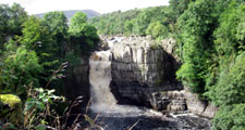
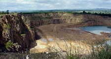
Igneous intrusions of hard dolerites of the Great Whin Sill form a series of striking outcrops and waterfalls (including High Force, England’s largest waterfall) along the southern flanks of Teesdale in an area defined to the north and south by the Teesdale and Lunedale faults. The Little Whin Sill outcrops locally in Weardale, and similar rocks can be found in linear dykes elsewhere. These only affect the landscape where they have been quarried.
View map of Solid Geology of County Durham
Much of the solid geology of the county is covered by a thick mantle of glacial drift, made up largely of boulder clay, with pockets of fluvio-glacial sands and gravels, morainic drift and lacustrine clays. Alluvial and river terrace sand and gravel deposits are found in the corridors of major rivers. Thick deposits of blanket peat cover the higher upland fells.
View map of the Drift Geology of County Durham
For further detailed information on the geology of County Durham download County Durham Geodiversity Audit
County Durham Geodiversity Audit (PDF, 6Mb)
Soils
Soils over most of the county are heavy, poorly drained gleys derived from glacial boulder clays with pockets of lighter soils associated with glacial sands and gravels. Brown earths and alluvial soils occur along the main river valleys. Calcareous brown earths are found on limestone outcrops along the escarpment and coast. In the west the combination of elevation, poor drainage and severe climate has lead to the development of extensive blanket bog of deep peat giving way on the drier eastern moors to thinner peats, humic gleys and podzols. Smaller pockets of earthy peats are found in the flat carrs of the Tees Plain. Substantial areas of land in the coalfield have been disturbed by opencast coal mining or the reclamation of derelict land and have either restored natural soils or rudimentary soils derived from shales and clays.


