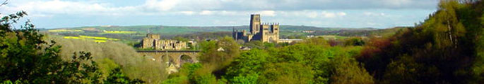
Wear Lowlands Trends and Pressures
The Wear Lowlands is a landscape of great contrasts. It contains many features with their roots in the medieval landscape including a large number of historic parklands and estate landscapes. At the same time it is an important communications corridor, carrying major modern roads and railway lines, and part of the heavily industrialised Durham coalfield. The landscape remains under ongoing pressure for new development for housing, industry, infrastructure and recreation.
Issues
- The scattered settlement pattern left by the coal industry together with the presence of busy roads, railways, waste disposal sites and industrial estates, power lines and communications masts, gives a semi-rural or urban fringe quality to parts of the landscape.
- The built environment of some former mining settlements is of a poor quality. Centres are often run down. Settlement edges are abrupt or poorly defined and fringed with allotments, pony paddocks and industrial land.
- The dereliction left by coal mining and associated industries has been largely reclaimed although some small areas remain. Reclaimed land is often of poor agricultural quality and lacking in mature landscape features.
- Some rivers and streams remain polluted by mine water or groundwater from colliery tips. The potential for further damage from mine water in the event of the pumping of the coal measures ceasing remains a potential threat.
- The presence of large urban populations brings a pressure for recreational development like golf courses, equestrian centres and pony paddocks in the countryside near towns and villages. Many farmsteads and agricultural buildings have been converted to residential use.
- Opencast mining has affected parts of the landscape, removing mature landscape features. Active opencast coal and brick-shale workings and landfill sites are locally intrusive features.
- Ancient semi-natural woodlands vary in condition. Some have been modified by the planting of exotics and a number were felled and replanted with conifers in the 1950’s. Some receive little active management.
- An increase in arable cropping in previously pastoral areas has led to a loss of old pastures and meadows, hedgerows, hedgerow trees, rigg and furrow and other archaeological features.
- Areas of semi-natural heathlands have been lost in the 20th century to development, agricultural improvement or opencast mining. Surviving areas of heath are isolated and vulnerable to the encroachment of bracken and woodland in the absence of grazing.
- Features of the industrial landscape have largely been removed in land reclamation. Those that survive are often undervalued and neglected.
- Some parkland landscapes survive only as relics, others are in decline through lack of positive management or have been developed as golf courses.
- The pressures of urban populations on the surrounding countryside leads in places to problems such as vandalism and fly tipping.
- There is ongoing pressure for new housing, industrial, commercial and waste development in areas outside of the Green Belt.
- The floodplain of the Wear is subject to localised flooding. Flood storage is limited by the presence of flood berms along the river.
- Small country lanes often carry high levels of traffic – causing physical damage to verges, ‘urban’ road detailing, and inhibiting use by pedestrians, cyclists and horse riders.
- The area has high levels of light pollution caused by urban and rural street lighting, and operational and security lighting on industrial and commercial premises.