Tees Lowlands Trends and Pressures
The landscape of the Tees Lowlands has seen considerable change in places during last hundred or so years. Urban and industrial development has transformed large areas, particularly in and around the Teesside conurbation to the south, the infrastructure serving those areas including major roads, railway lines and power lines spreading out across the surrounding areas. It remains for the most part a rural landscape. Its fertile soils are well suited to cultivation and agricultural intensification and specialisation have had a substantial impact on the character and biodiversity of its farmlands.
Issues
- The presence of nearby urban populations brings a pressure for recreational development like golf courses, equestrian centres and pony paddocks in the countryside near towns and villages, which weaken its rural character. The conversion of many farms and farm buildings to residential use adds to this ‘suburbanising’ process.
- An increase in the extent and intensity of arable cropping has led to a loss of old pastures and meadows, hedgerows, hedgerow trees, field ponds, rigg and furrow and other archaeological features. Parts of the landscape have become very open and featureless.
- Flower-rich neutral pastures and meadows have declined with agricultural improvement. Old grasslands are now rare and survive only as isolated fragments – often associated with areas of medieval rigg and furrow.
- The enlargement and amalgamation of arable fields has lead to heavy fragmentation of the hedgerow network in places. Hedges tend to be cut frequently and low, reducing their vigour as well as their wildlife and landscape value.
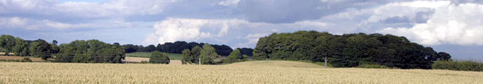
- Hedgerow trees are particularly important features, helping to articulate space in this open, often relatively flat landscape. Many are senescent or suffering from the effects of close cultivation, and there are low levels of recruitment of young trees to replace those that die.
- Successive drainage schemes in the Carr landscapes have lowered water tables and the area of wetland and wet pasture has been significantly reduced.
- Some natural watercourses have been straightened. Minor watercourses are often heavily engineered.
- Some historic parklands survive only as relics, others are positively managed. Surviving features like water bodies and veteran trees in relic parklands are in progressive decline and likely to disappear without intervention and some degree of restoration.
- The tranquillity and rural character of the countryside is eroded in places by presence of major roads like the A1 (M), the east coast main line and major overhead power lines.
- Parts of the Tees Lowlands – and particularly the lowland plain in the east – have a relatively good wind resource. The new wind farm at High Volts on the county boundary is likely to be followed by further development – possibly of medium sized wind farms – in this area.
- There is localised pressure for new urban and industrial development associated with the larger settlements.
- Small country lanes often carry high levels of traffic – causing physical damage to verges, ‘urban’ road detailing, and inhibiting use by pedestrians, cyclists and horse riders.