• Skip to main content
  • Skip to primary sidebar
Durham Landscapes

Understanding and conserving the diversity of the County Durham Landscape

  • Character
  • Strategy
  • Guidelines
  • Weardale, North Pennines © Copyright DCCMethodology

  • Coalfield Upland Fringe © Copyright Peter McDermott, www.geograph.org.uk and licensed for reuse under a Creative Commons Licence (see Legal Information)The Landscape Strategy

Strategy Overview

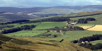
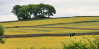
This Landscape Strategy is a non-statutory plan which addresses issues that affect the varied landscapes of County Durham by setting out objectives for their conservation, restoration and enhancement.  It is based on the County Durham Landscape Character Assessment.

The following sections explain more about the landscape strategy, the background to its preparation, and how it should be used.

Primary Sidebar

  • County Durham Landscape Strategy
  • Strategy Overview
    • The Landscape Strategy
    • Methodology
  • Broad Issues
    • Climate Change
    • Biodiversity
    • Geodiversity
    • Cultural Heritage
    • Tranquillity
    • Green Infrastructure
  • Land Management
    • Agriculture
    • Woodland and Forestry
    • Moors and Heath
    • Field Boundaries
    • Rivers and Wetlands
    • Designed Landscapes
  • Development
    • Housing
    • Industry
    • Transport
    • Minerals
    • Waste
    • Renewable Energy
    • Recreation and Tourism
  • County Character Area Strategies
    • Dales Fringe
    • North Pennines
    • Wear Lowlands
    • West Durham Coalfield
    • East Durham Limestone Plateau
    • Tees Lowlands

  • About this Website |
  • Accessibility Statement |
  • Legal Information |
  • Contact Us |
  • Maps
  • Copyright © 2025 Developed by Durham County Council.
Durham County Council Logo
Top of page