Field Boundaries
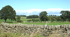
Field boundaries in the County date from many periods and include both ancient and modern features. Many survive from the medieval landscape, and some perhaps from its Saxon roots, but the landscape is dominated by hedgerows and walls established in successive periods of enclosure between the 16th and 19th centuries.
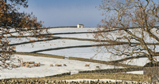
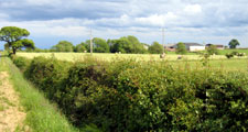
Ancient hedges are found along old parish and township boundaries and along old roads and lanes. Early town field enclosures – often irregular in pattern or following the curved alignment of arable strips – are a feature of the lowlands and land close to upland villages. Parliamentary enclosures – with regular grids of thorn hedges or walls – are found in the former wastes of the upland fringes.
Hedgerows are characteristic of the lowlands and walls of the uplands with a mixture of boundaries in the upland fringes. Wet ditches are used as field boundaries in the lowland carrs. Hedges in the County are generally species poor and dominated by Hawthorn – though Holly and Blackthorn are also common. Older hedges are more diverse and often distinguished by the presence of Hazel.
Tree cover varies considerably with abundant trees in the older field systems of the lower dales and pastoral upland fringe valleys. In the arable landscapes of the lowlands of the Tees and the Wear, and the open farmland of the limestone plateau in the east hedgerow trees are scarce. Ash is the commonest hedgerow tree across the county, having been favoured for farm timber. Oak and Sycamore are also common.
Further Information
- The County Durham Landscape Strategy for Field Boundaries.
- For more detailed information on field boundaries visit the Hedgerow Guidelines pages.


