Dales Fringe Trends and Pressures
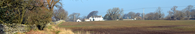
The landscape of the Dales Fringe is one of relatively slow change. For centuries a settled landscape of mixed farmland, the vale of the tees has seen the balance of arable and pasture change periodically but without a radical effect on its character. In many places field systems laid out in the C17th remain relatively intact today. This continuity in the landscape is due in part to the influence of the larger estates.
Issues
- In the upland fringes grazing regimes have become more extensive and in places field boundaries have been abandoned or are suffering from neglect. Hedges here are often reduced to lines of overgrown thorns and some dry stone walls are in poor condition.
- On more sheltered fertile land, and particularly in arable farmland, hedgerows are often cut annually, and low, and are in decline in places.
- The stock of field and hedgerow trees – which are strongly characteristic features of the more sheltered parts of the vale – is slowly declining. Many mature trees are approaching the end of their lives and there is little recruitment of younger stock
- Changing practices in agriculture have led to an increase in arable cropping in previously pastoral areas, removal of hedgerows, improvement of older, more diverse grasslands, and conversion from hay-making to silage production.
- A number of ancient semi-natural woodlands were replanted with commercial species in the C20th. The majority of woodlands are actively managed under the Woodland Grant Scheme but some receive little active management.
- The strong vernacular character of older villages and buildings has been weakened in places by more recent development and by the use of newer building materials. Farms and agricultural buildings are increasingly being converted to residential use as agricultural employment declines.
- Changes in working and commuting patterns have led to increased traffic levels on rural roads.
- The tranquillity and rural character of the countryside between towns and villages is eroded in places by the presence of major highways – particularly the A66.
- Historic parks and gardens are an important component of the landscape and need sustained management. Some parkland features are in decline.
- Parts of the Dales Fringe have a relatively good wind resource and there may be pressure for the development of wind farms in some locations.
- There are a number of former army camps in the vale, some of which have a rather derelict or incongruous appearance in the rural landscape.
- Some pockets of rigg and furrow survive from the medieval landscape. Its historical significance is often poorly understood and it can be vulnerable to development or cultivation.
- Mineral extraction has had a localised impact on the landscape and active quarries can be locally visually intrusive.