• Skip to main content
  • Skip to primary sidebar
Durham Landscapes

Understanding and conserving the diversity of the County Durham Landscape

  • Character
  • Strategy
  • Guidelines
  • Romaldkirk Conservation Area - © Copyright Bill Henderson and licensed for reuse under a Creative Commons Licence (see Legal Information)

Conservation Areas

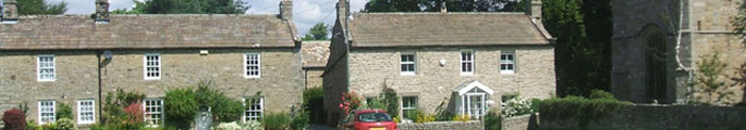
Conservation Areas are areas of special architectural or historical interest that are designated by local authorities to preserve or enhance their character and appearance. There are 94 Conservation Areas in County Durham, ranging from urban market places and village greens to loose-knit dales villages, areas of well-preserved terraced housing, and historic parklands.

Conservation Areas

View an interactive map of Conservation Areas in County Durham

Note: the map shows Conservation Areas as updated on 30 November 2010. If you are in doubt about whether an area is within a Conservation Area, check with Durham County Council planning team.

Further Information

  • Durham County Council Conservation Areas webpage.

Primary Sidebar

  • County Durham Landscape Character
  • The Durham Landscape
    • Physical Influences
    • Human Influences
    • The Modern Landscape
    • Perceptions of the Landscape
    • Designated Landscapes
  • Character Overview
    • The Landscape Character Assessment
    • Assessment Methodology
  • Character Areas and Types
    • County Character Areas
    • Broad Landscape Types and Character Areas
    • Local Landscape Types and Subtypes
    • Landscape Classification

  • About this Website |
  • Accessibility Statement |
  • Legal Information |
  • Contact Us |
  • Maps
  • Copyright © 2025 Developed by Durham County Council.
Durham County Council Logo
Top of page