Agriculture
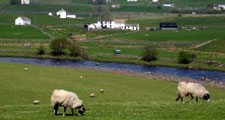
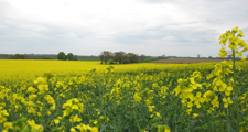
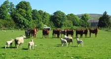
The more fertile lowland landscapes of the eastern and central parts of the county have long supported arable or mixed farming. There is currently a strong emphasis on arable cropping predominantly of cereals (wheat and barley) and oil seed rape, combined in places with the fattening of beef cattle or sheep. The pastoral uplands of the west of the county support livestock farming, principally of beef or dairy cattle and hardy hill sheep, like Swaledales and Scottish Black-face, which graze extensive moors of grass and heather. Much of the upland area of the county is designated as a Less Favoured Area (LFA).
The upper dales of Weardale, Rookhope, Teesdale, Baldersdale and Lunedale form part of the Pennine Dales Environmentally Sensitive area where flower rich upland hay meadows and pastures are managed traditionally to maintain their wildlife and landscape value.
View Agricultural Land Use Map
Further Information
- The County Durham Landscape Strategy for Agriculture.
- To view the boundaries of the Less Favored Areas visit the Multi-Agency Geographic Information for the Countryside (MAGIC) website.


