Topography and Drainage
Topography
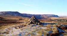
The high summit ridge of the North Pennines lies largely outside of the County to the west. Mickle Fell is its southernmost outpost and at 790m is the highest point in the county. High dissected ridges separated by broad dales spread out from the summit ridge. To the south the broad plateau of the Stainmore Gap falls to the broad vale of the Tees. The lower uplands of the Pennine fringe fall gradually eastwards to the lowlands of the Wear Valley and the Tees Plain. Divided by rivers and streams flowing generally west to east they form a strongly rolling landform of sequential ridges and valleys.
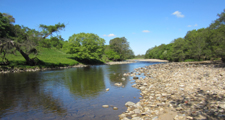
The valley of the Tees in the south opens out into a broad, gently undulating plain. To the north the River Wear carves an incised course in a broad valley which lies between the spurs of the Pennine fringe ridges and the escarpment of the limestone plateau to the east. Across these valley landscapes, rivers and streams cut down through glacial sediments to form steep sided denes and bluffs beside intermittent narrow floodplains. In the east, a low upland of Magnesian Limestone falls from a prominent escarpment in the west towards the coast where it is incised by steep denes such as Castle Eden Dene.
The coast itself is made up of alternating sandy bays and rocky headlands backed by low cliffs of soft Magnesian Limestone topped by steep slopes of boulder clay. To the south the cliffs disappear and are replaced by sand dunes.
View map of the Topography of County Durham
Drainage
The valleys of western and central Durham are drained by the Wear and the Tees and their many tributaries. In the north the Derwent and the Team flow northwards to the Tyne. The undulating plain of the Tees contains poorly drained flats and carrs drained by wandering, slow moving tributaries like the River Skerne. East of the limestone escarpment the plateau is drained by minor streams flowing eastwards through the coastal denes to the North Sea.


