Site Selection
Published Guidance
There is some guidance on site selection in The UK Forestry Standard (Standard Note 2). This can be downloaded from the Forestry Commission website.
The County Durham Woodland Strategy contains a spatial strategy for new woodland planting which identifies broad sensitivities and priorities for woodland creation at a landscape scale. You can view the Woodland Strategy Priority Map as an interactive map.
General Principles
- Find out if there are any landscape designations – SSSI, County Wildlife Sites, Scheduled Ancient Monuments etc – that might affect the suitability of the site for planting. The Forestry Commission’s Land Information Search can be used to find some of the national designations affecting your site.
- Avoid areas of archaeological sensitivity. The County Archaeologist and local history societies may have information on elements of historical interest. Much of the Historic Environment Record is available online through the ‘Keys to the Past‘ website, but only shows recorded sites.
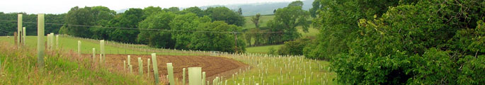
- Look out for relic features on the ground like rig and furrow and old boundaries.
- Try to select sites that enhance the setting of historic features and designed landscapes rather than those that obscure them.
- Avoid areas of ecological sensitivity. The County Ecologist and Durham Wildlife Trust may have information on features of nature conservation interest. Avoid planting on Durham Biodiversity Action Plan priority habitats and consider secondary impacts (shading, drainage, fragmentation, tree seeding) that might affect them.
- Consider landscape character. The Character Areas Overview give guidance on character, sensitivity and priorities for new woodland planting in County Character areas.
- Avoid sites that obscure important local views.
- Take advice. The Forestry Commission provide advice, grants and useful publications on creating new woodlands.
- Look for sites that provide opportunities to enhance biodiversity – for example by buffering, extending or linking native woodlands, or providing habitat for Durham Biodiversity Action Plan priority species like Black Grouse.
- Look for sites that strengthen landscape character – by echoing the pattern of woodland cover characteristic of the local landscape; by screening ‘detractors’ like industrial buildings, masts and pylons, busy roads etc; or by restoring derelict or degraded land.
- Look for sites that offer new opportunities for recreation – especially near towns and villages – or where new paths and trails might enhance the local footpath network.
- Look for sites that offer opportunities to improve water quality – for example by restoring bankside vegetation to river and streamsides, or by buffering streams and ditches against run-offs from agricultural land.
- Discuss proposals for new woodland with interest groups or the local community to identify local sensitivities and priorities.
- Take account of, deer, rabbit and squirrel strategies of local management groups and the potential impacts of new woodland on these.