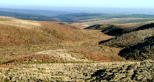
Moorland Fringe
Land Management
Natural Features, Watercourses and Wetlands
- Protect gills and ravines from stock to encourage regeneration of semi-natural vegetation including scrub and open woodland.
Moor and Heath
- Conserve and enhance areas of semi-natural acid grassland and heath to increase their biodiversity by adopting appropriate stocking densities and/or burning regimes.
- Restore moorland intakes and allotments on peaty soils to heather moorland by reducing stocking levels and ditch blocking.
Farmland
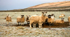
- Manage semi-improved grasslands to enhance biodiversity by adopting appropriate stocking levels and avoiding further improvements such as drainage, ploughing and reseeding. Limit the use of fertilisers, herbicides and liming.
Trees, Woodlands and Forestry
- Conserve and restore gill woodlands by fencing and excluding livestock to promote natural regeneration.
- Plant new native oak-birch and juniper woodlands in gills and ravines, valley bottoms and lower slopes.
- Restructure forests and plantations to restore damaged habitats and archaeological sites, increase species diversity, and soften geometric outlines. Consider removal of visually intrusive isolated plantations.
- Conserve and reinforce stands of shelter trees around isolated farmsteads.
Cultural Features
- Protect archaeological features by avoiding overstocking or supplementary feeding on sensitive sites.
- Protect and conserve lead mining features – avoid physical damage, removal or infilling; consolidate important structures and sensitively gate open shafts and adits taking archaeological advice.
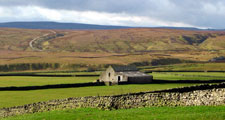
- Conserve and maintain historic field barns, farm buildings and lime kilns.
- Conserve and enhance old quarries by avoiding tipping and excluding livestock to promote natural regeneration.
Field Boundaries
- Maintain and restore dry stone walls.
Development
Agricultural Buildings
- Site new farm buildings close to existing buildings where possible, and reflect their scale, character and materials.
- Reduce the impact of larger modern buildings by careful selection of colour, breaking up mass and planting screening belts of native species. Follow the North Pennines AONB Agricultural Building Design Guide.
Energy, Telecommunications and Infrastructure
- Avoid the siting of tall structures such as masts, pylons and wind turbines in the Moorland Fringe landscape.
- Where masts, pylons or domestic scale wind turbines are needed, site them close to existing buildings and forest edges. Where possible underground services.
- New buildings should only be developed in exceptional circumstances – they should be closely related where possible to existing buildings and should utilise traditional materials and building styles.
Mineral Workings
- Avoid damage to sensitive natural landforms.
- Avoid breaching skylines with extraction areas or storage mounds.
- Restore quarry faces to naturalistic profiles using restoration blasting.
- Restore quarries to semi-natural woodland, grassland, wetland and bare rock habitats using natural regeneration where appropriate.
Tourism and Recreation
- Tourism and recreational development should be undertaken in such a way as to avoid any urbanising influence on the landscape. Existing buildings should be re-used where possible. New buildings should reflect the scale, form, materials and vernacular detailing of traditional farm buildings in the area.
- Facilities and infrastructure for tourism and recreation – paths, car parks, litter bins, signage and interpretation – should be provided only where absolutely necessary, and should be sensitively designed and low key to avoid exerting an urbanising influence on this very rural landscape.
Further Information
- Moorland Fringe Character Assessment
- North Pennines Strategy