Late Medieval
(1066-1540)
The village system established during the Saxon period became more highly developed in the Middle Ages. Many villages appear to have been re-structured during the late 11th and 12th centuries, particularly those under monastic control, and show a typically regular layout of tofts or house plots arranged around a central green. The land was divided administratively into townships in which large arable fields, usually three in number, were cultivated in strips with one field lying fallow each year. Also included in the township land would be meadows, pastures, woodland and wastes or ‘moors’ of rough grassland or heath.
The period also saw an expansion of settlement in the uplands. Scattered villages surrounded by their open fields occupied ridge top sites in the upland fringes, and sheltered valley floors in the dales. Between them lay extensive wastes of common grazing. Some of the land was worked from seasonal livestock farms or sheilings, which later developed into permanent farms. New farms and estates were enclosed from the waste, often centred on fortified or moated halls. The medieval landscape also contained a number of deer parks, particularly in the Pennine fringe, and parts of the dales were forested. Forests were areas of open grassland, moor and woodland managed for the hunting of deer but containing some enclosed meadows or friths for gathering winter fodder.
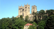
The area formed part of the Palatinate of Durham where the Bishops enjoyed royal privileges and owned substantial estates including townships, demesne farms, deer parks, quarries and lead, silver, iron and coal mines. The ecclesiastical and political centre of the County was Durham with its Norman castle and Cathedral.
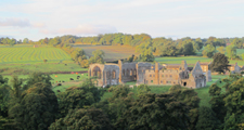
The Cathedral housed the shrine of St Cuthbert and was an important pilgrimage site. Many other great buildings were developed during the period including abbeys at Egglestone and Finchale and castles at Auckland, Raby and Barnard Castle.
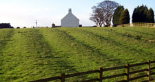
While the most conspicuous remains of the medieval period are the great castles and abbeys, many other relics survive in the modern landscape – which in places owes much of its structure to the villages and roads established in this period. The remains of medieval rigg and furrow can be found in older pastures around villages across the county and its curving pattern is preserved by countless hedges and walls. The ancient boundaries of parishes and old town fields can often be traced through later field systems.


