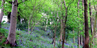
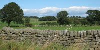
• Skip to main content
  • Skip to primary sidebar
Durham Landscapes

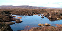
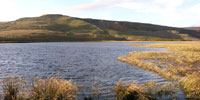
Understanding and conserving the diversity of the County Durham Landscape

  • Character
  • Strategy
  • Guidelines
  • Ancient WoodlandWoodland and Forestry

  • Browney ValleyAgriculture

  • Drystone Wall and Hedges - MarwoodField Boundaries

  • Bink Moss - © Copyright David Brown, www.geograph.org.uk and licensed for reuse under a Creative Commons Licence (see Legal Information)Moors and Heath

  • Temple of Minerva, Hardwick Park - © Copyright Mick Garrett, geograph.org.uk and licensed for reuse under a Creative Commons Licence (see Legal Information)Designed Landscapes

  • Fish Lake, Lune Dale © Copyright Mike Borroff, geograph.org.uk and licensed for reuse under a Creative Commons Licence (see Legal Information)Rivers and Wetlands

Land Management

The character of the landscape is heavily influenced by the way it is managed. The following sections describe the issues and objectives for land management in the County.

Primary Sidebar

  • County Durham Landscape Strategy
  • Strategy Overview
    • The Landscape Strategy
    • Methodology
  • Broad Issues
    • Climate Change
    • Biodiversity
    • Geodiversity
    • Cultural Heritage
    • Tranquillity
    • Green Infrastructure
  • Land Management
    • Agriculture
    • Woodland and Forestry
    • Moors and Heath
    • Field Boundaries
    • Rivers and Wetlands
    • Designed Landscapes
  • Development
    • Housing
    • Industry
    • Transport
    • Minerals
    • Waste
    • Renewable Energy
    • Recreation and Tourism
  • County Character Area Strategies
    • Dales Fringe
    • North Pennines
    • Wear Lowlands
    • West Durham Coalfield
    • East Durham Limestone Plateau
    • Tees Lowlands

  • About this Website |
  • Accessibility Statement |
  • Legal Information |
  • Contact Us |
  • Maps
  • Copyright © 2025 Developed by Durham County Council.
Durham County Council Logo
Top of page