Gritstone Upland Fringe
Land Management
Natural Features, Watercourses and Wetlands
- Protect the banks of streams from stock to encourage regeneration of riparian woodland.
Farmland
- Maintain and enhance semi-improved pastures, wet pastures and rough grazing by adopting appropriate stocking levels and avoiding further improvements such as drainage, ploughing and reseeding.
Trees, Woodlands and Forestry
- Increase the proportion of locally native species – particularly sessile oak and downy birch -when restocking plantations.
- Plant new small, mixed or broadleaved farm woodlands – avoiding sites of existing nature conservation value.
- Plant small woodlands and tree groups to screen larger modern farm buildings.
Cultural Features
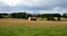
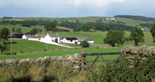
- Conserve and maintain traditional field barns and farm buildings.
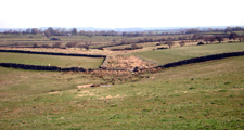
- Protect archaeological features, including carved stones and rigg and furrow, from damaging activities such as cultivation, overstocking, or poaching.
Field Boundaries
- Protect, restore and maintain existing dry stone walls and hedgerows. Renovate overgrown gappy hedges by laying or coppicing and gapping up.
- Reinstate hedges and walls where they have been replaced by fences – and particularly in areas of older enclosure, in linear field systems, and along enclosure roads and lanes.
- Protect and maintain existing hedgerow and field trees where they occur. Plant new field boundary trees (ash, oak, sycamore) or tag hedgerow saplings to replace the maturing stock in areas where they are characteristic.
Development
Agricultural Buildings
- Site new farm buildings close to existing buildings where possible, and reflect their scale, character and materials.
- Reduce the impact of larger modern buildings by careful selection of colour, breaking up mass and planting screening belts of native species.
Energy, Telecommunications and Infrastructure
- Site communications masts, pylons or domestic scale wind turbines close to existing buildings or woodland edges, avoiding clean and open skylines. Where possible bury cables underground.
- Avoid ‘urban’ detailing in minor road works.
Minerals and Waste
- Avoid damage to sensitive natural landforms.
- Avoid breaching local skylines with extraction areas or storage mounds.
- Restore quarry faces to naturalistic profiles using restoration blasting.
- Restore quarries to semi-natural woodland, grassland, wetland and bare rock habitats using natural regeneration where appropriate.
Further Information
- Description of Gritstone Upland Fringe Landscape Character
- Dales Fringe Strategy